Land
Features and description
- Tenure: Freehold
- Rare opportunity to acquire strategic land located on the Ipswich Urban Fringe
- Close to A137 arterial road which runs between the A14 and Ipswich Town Centre
- Opportunity for carbon offsetting and biodiversity enhancements
- Close to the A14 trunk road and the Junction 56 interchange with the A14 and A137.
- Nearby to Ipswich Port, Suffolk Food Hall, Suffolk Leisure Park and residential settlements
Description
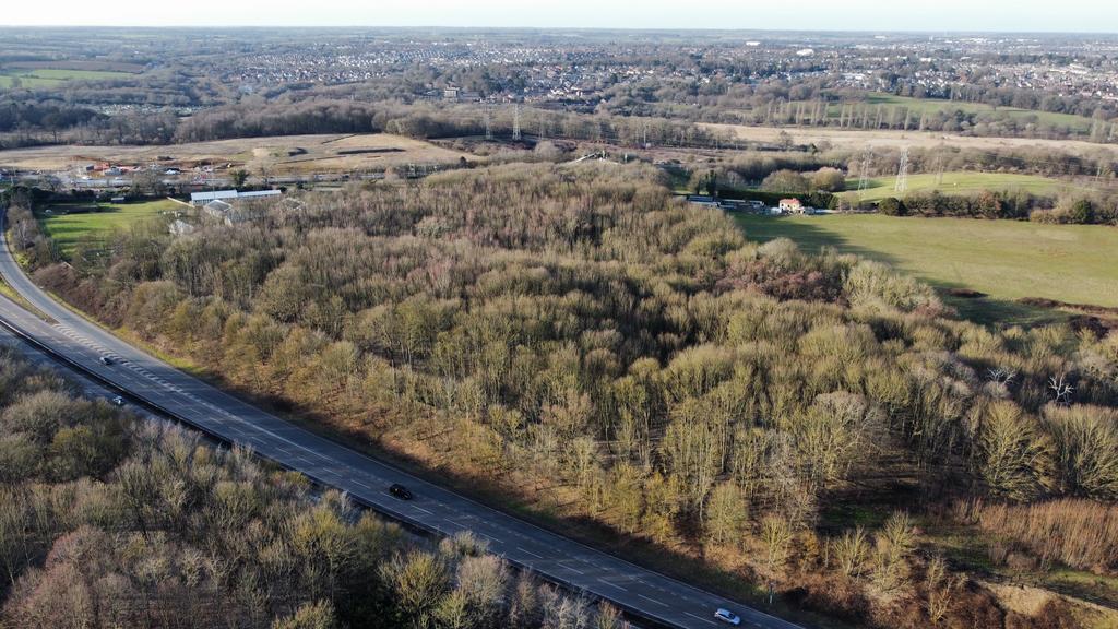
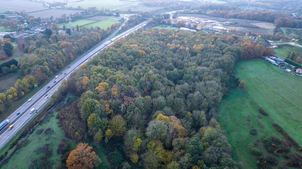
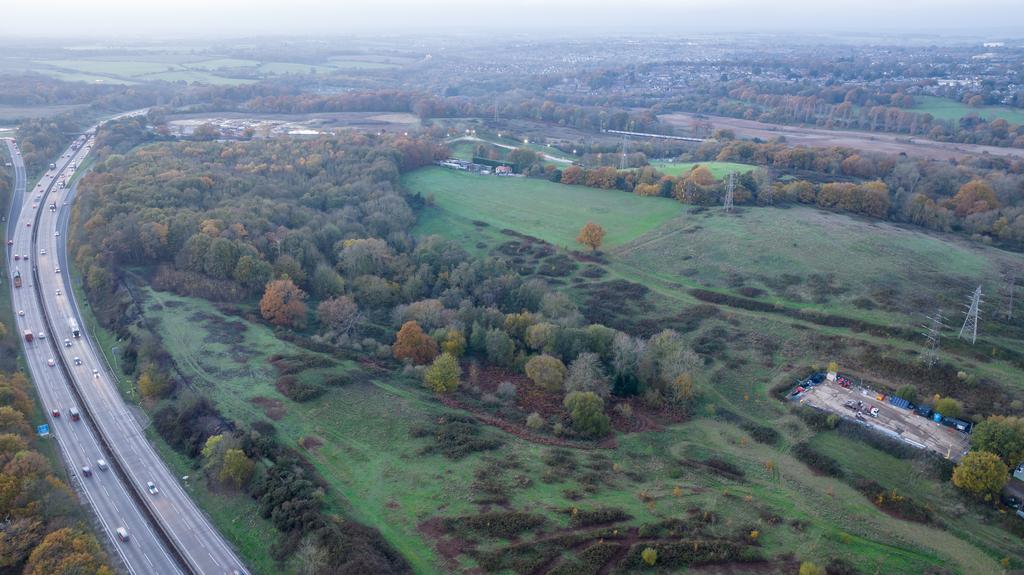
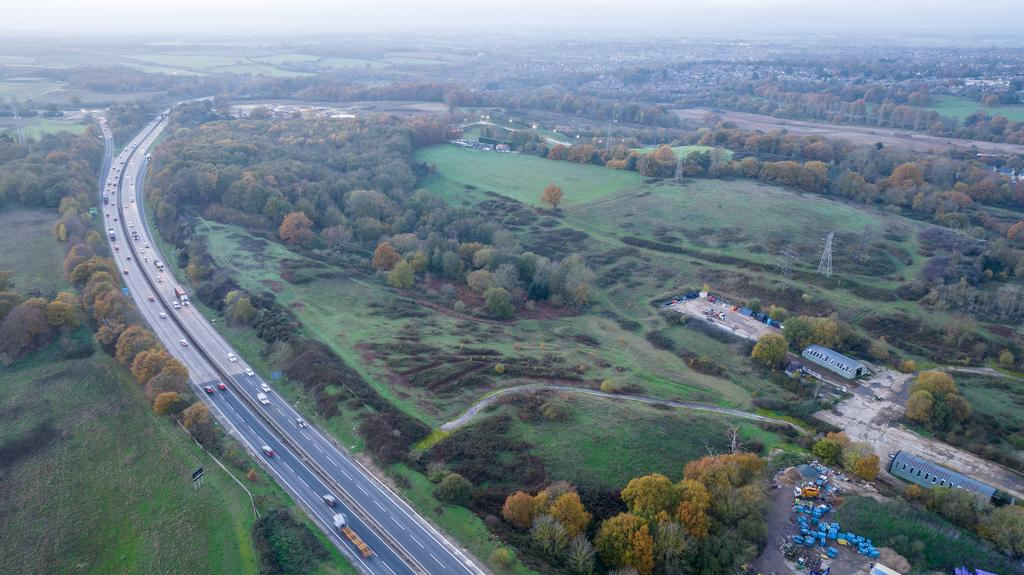
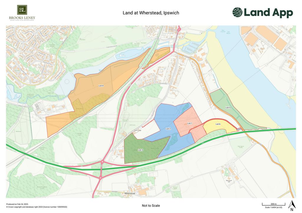
Lot 3 comprises a single parcel of mature woodland, which extends to approximately 17.10 acres (6.92 hectares). The woodland comprises a range of species, typically hardwood and is accessed directly from Bourne Hill.
Lot 3 provides a rare and unique opportunity to acquire a substantial woodland, with excellent access, close to Ipswich and with good road links. The woodland falls within an Area of Outstanding Natural Beauty and provides a desirable amenity opportunity as well as the potential to capitalise on carbon offsetting opportunities.
The woodland has not been subject to any Woodland Grant Scheme’s during the vendors ownership.
The woodland is subject to a lease, however, the lease can be terminated on no less than six month's written notice.
Location
Ipswich is the county town of Suffolk with a population of approximately 130,000 and a catchment area of over 250,000. It occupies a strategic position close to the International Container Port of Felixstowe and the interchange of the A12 and A14 trunk roads. The town is also served by a rail service to London Liverpool Street with a journey time of approximately 75 minutes.
This opportunity provides a portfolio of land and buildings sitting in close proximity to Ipswich and the newly upgraded Junction 56 of the A14/A137 interchange. The land offers extensive opportunities for alternative uses including Biodiversity Net Gain, Carbon Offsetting and Natural Capital opportunities, as well as more traditional commercial, amenity and agricultural uses.
Basic Payment Scheme, Countryside Stewardship and Woodland Grant Scheme
The land is registered with the Rural Payments Agency and the vendor has historically claimed under the Basic Payment Scheme. The vendor reserves the right to claim the 2023 claim and therefore the purchaser will be obligated to comply with the cross-compliant management requirements until the 31st December 2023.
The vendor has not entered into any Countryside Stewardship Scheme or Woodland Grant Scheme.
Sporting Rights
Sporting Rights are in hand and will be included in the sale.
Minerals
So far as they are available minerals are included in the sale.
Wayleaves, Easements and Rights of Way
As referred to within the description of the relevant Lots, lots 4, 5 and 6 are affected by a public footpath.
Lots 1, 2, 4 and 5 are also affected by 132KV pylons and/or wires, as referred to in these particulars and as can be seen on the attached plan.
In regard to Lot 2, a Right of Way is reserved in favour of the purchaser off Bourne Hill and over the adjoining land. A further Right of Way is reserved via Lot 1, providing access from the B1456. Both Rights of Way are shown hatched red on the attached plan.
In addition to the above, there is a historic Wayleave Agreement concerning low voltage and high voltage overground and underground cables, a copy of which can be provided on request. It is understood the overground cables no longer affect the property, however, it is advised that any interested party undertakes its own research in regards to the underground cables.
Services
There are no services connected to Lots 2, 3, 4, 5 and 6, however, given the location of the various parcels of land, it is assumed services would be within close proximity.
Method of Sale
The land is offered for sale as a whole or in lots by private treaty.
VAT
It is not expected that VAT will be charged on the sale but should the sale of the property or any Rights attached to it be deemed chargeable for the purposes of VAT, this will be payable in addition to the sale price.
Plans, Areas and Schedules
These are based on the Ordnance Survey and are for reference only. The Purchaser shall be deemed to have satisfied themselves as to the description of the property and any error or mis-statement shall not annul the sale nor entitle any party to compensation. All Plans are for identification purposes only and in the event of any discrepancies between the Plans and any area, schedule, or the Land Registry the Land Registry shall prevail.
Boundary Fencing Obligation
Should Lots 1 and 2 be sold to separate parties, the purchaser of Lot 2 shall be obligated to fence the boundary between Lot 1 and 2 within 6 weeks of completion, with the fencing being no less than post and two strands of wire.
Skylark Plot Obligation
The vendor has entered into a planning obligation to provide six 5m x 5m Skylark plots on land falling within Lots 2 and 6. More information can be provided on request.
Important Notes
The Purchaser shall be deemed to have full knowledge of the boundaries of the property and the ownerships thereof. The property is sold subject to any development plans, tree preservation orders, Ancient Monument Orders, Town Planning Schedules and resolutions that may or may not come into force. Any plans are deemed to be representative of the property, but no assumption should be made in respect of any parts of the property.
Legal Costs
Each party is to be responsible for their own legal costs incurred in the transaction.
Property information from this agent
About this agent


