No bars, no signal predictedOne bar, reliable signal unlikelyTwo bars, may experience problems with connectivityThree bars, likely to have good coverage and receive a data rate to support basic web servicesFull bars, likely to have good coverage indoors and to receive an enhanced data rate to support multimedia services
Skip to main content
Photo 7
Photo 7
Photo 1
Guide price£109,500
Added > 14 days

Land for sale

Approximately 43.49 acres of Land, North of Glyncoli Farm, Treorchy
Virtual tour
Save
Land
0 bed
0 bath

Key information

Tenure: Ask agent
Council tax: Ask agent
Broadband: Super-fast 80Mbps *
Water: Ask agent
Heating: Ask agent
Electricity: Ask agent
Sewerage: Ask agent
Discover more information

Property description & features

  • Approximately 43.49 acres of land
  • Rural Location
  • Unique opportunity
  • For sale by Private Treaty
  • Natural Water Supply
Situation
The land is situated directly to the north of Treorchy. The land is a short travelling distance from Treorchy, Tonypandy & Porth providing convenient amenities as well as good transport links. Please see the attached location plan.

Description
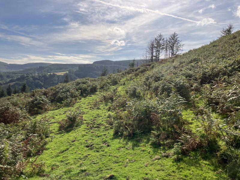
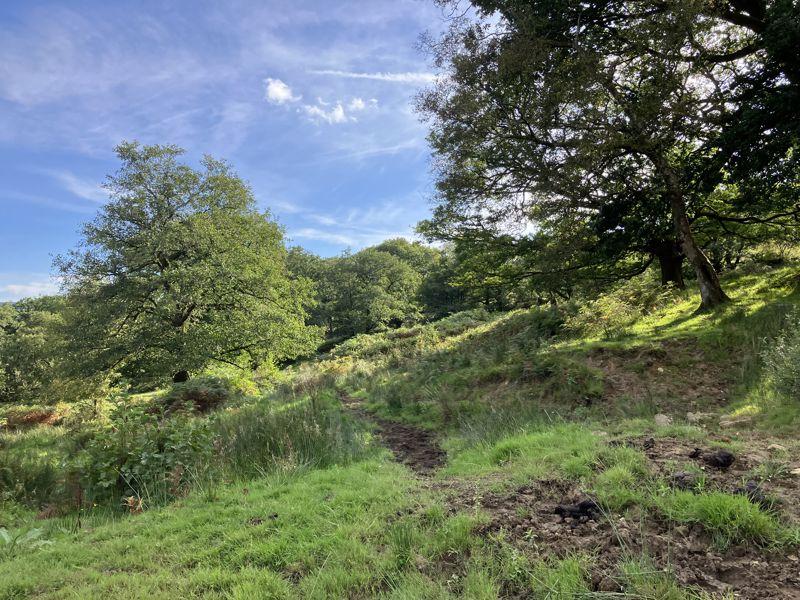
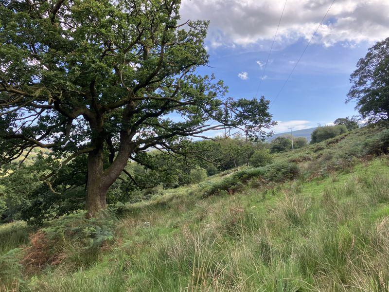
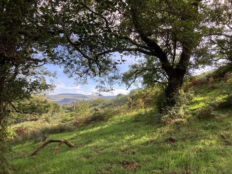
The property extends to approximately 43.49 acres of gently sloping or steep pasture land and woodland as edged red on the attached site plan.

The woodland extends to approximately 6.62 acres. The land would benefit from land management as it is overgrown with fern, briars and trees but offers biodiversity and potential access to public money for public goods schemes

The land is suitable for grazing purposes with potential considered for agricultural, equestrian and amenity use.
The land also benefits from a natural water supply along its North Eastern boundary.

Approximately 13.90 acres of the land is identified as a Site of Importance for Nature Conservation (SINC). Of the 13.90 acres, approximately 2.57 acres is designated as Ancient Woodland, comprising of Oak and Birch Trees. Please refer to RCT Adopted Local Development Plan for more information. Adopted Local Development Plan Link:
The area shown hatched blue on the attached plan runs with the subject land but is not registered. However, the land benefits from a prescribed Right of Way across the area hatched blue.

We are aware that the property does currently have Himalayan balsam.

Access
Access to the land is from a field gate off Cemetery Road

Plan
The plans attached to these particulars are shown for identification purposes only and, whilst every care has been taken, its contents cannot be guaranteed.

Services 
The land benefits from a natural water supply.

Wayleave/Easements/Rights of Way
The property is being sold subject to and with the benefit of all rights including: rights of way, whether public or private, light, support, drainage, water and electricity supplies and other rights and obligations, easements and quasi-easements and restrictive covenants and all existing and proposed wayleaves for masts, pylons, stays, cables, drains, water and gas and other pipes whether referred to in these particulars or not. There is one footpath crossing the property along the Southern Boundary in a West to East direction.

Boundaries
The purchaser(s) shall be deemed to have full knowledge of all boundaries and neither the vendor nor the vendors agents will be responsible for defining the boundaries of the ownership thereof.

Basic Payment Scheme
The land is being sold without the benefit of Basic Payment Scheme Entitlements.

Tenure and Possession 
Freehold with Vacant Possession upon completion. 

Guide Price
Guide Price – £119,000


Health and Safety
Given the potential hazards of agricultural land we ask you to be as vigilant as possible when making your inspection for your own personal safety.  Nb: There are currently mares with foals at foot on the land.

Method of Sale
The property is offered for sale by Private Treaty.

Please contact Emily Flint or Elliott Rees for more information
[use Contact Agent Button] / [use Contact Agent Button]
[use Contact Agent Button] / [use Contact Agent Button] 

Directions
Postcode: CF42 6TU

From Ysbyty Cwm Rhondda Hospital. Head northwest on Partridge Road/A4058 for 3.1 miles. Continue onto High Street/A4061. In 0.3 miles, turn right onto Cemetery Road. Continue for 0.3 miles, pass the Cemetery on your right hand side. Continue for 0.2 miles, cross the cattle grid and the land is located on your left-hand side.


Tenure: Freehold

Property information from this agent

Places of interest

    Our agency was established in 1926, specifically to provide professional advice to the agricultural and rural community of Glamorgan – a role we continue to provide to this day. The current Partners and Staff still possess the same in-depth regional and local knowledge which have ensured the continued success of the company but are also conversant in relevant UK and EU policies which have an impact on decision-making in rural areas, enabling them to provide up to date advice you can rely on. Through our diverse wealth of experience, Herbert R Thomas endeavours to provide a personal service tailored to the individual requirements and aims of our clients.

    See more properties like this:

    *DISCLAIMER

    Property reference 12164965. The information displayed about this property comprises a property advertisement. OnTheMarket.com makes no warranty as to the accuracy or completeness of the advertisement or any linked or associated information, and OnTheMarket.com has no control over the content provided by the agent or developer. This property advertisement does not constitute property particulars. The information is provided and maintained by Herbert R Thomas - Cowbridge.

    OnTheMarket may have applied supplementary data to this property listing, including:

    Broadband availability and predicted speed: obtained from Ofcom on October 12, 2023

    Broadband speed is measured in megabits per second, with the number returned showing how fast the connection is. Each reading is based on the highest predicted speed of any major broadband network for services that deliver the download speeds. The following are the different readings that we may display:

    Basic: Up to 30 Mbit/s
    Super-fast: Between 30 Mbit/s and 300 Mbit/s
    Ultra-fast: Over 300 Mbit/s

    The data is updated three times a year. The checker results are predictions and should not be regarded as guaranteed. For more information, see: https://checker.ofcom.org.uk/en-gb/about-checker#Answer_0_2

    Mobile phone signal availability and predicted strength

    Mobile signal predictions are provided by the four UK mobile network operators: EE, O2, Three and Vodafone. Predictions can vary significantly from the coverage you may actually experience as a result of local factors (especially terrain). Ofcom has tested the actual coverage provided in various locations around the UK to help ensure that these predictions are reasonable. The values shown against a property can be broken down as follows:

    Clear: No bars, no signal predicted
    Red: One bar, reliable signal unlikely
    Amber: Two bars, may experience problems with connectivity
    Green: Three bars, likely to have good coverage and receive a data rate to support basic web services
    Enhanced: Full bars, likely to have good coverage indoors and to receive an enhanced data rate to support multimedia services

    Energy Performance data and Internal floor area

    Any supplementary data should not be relied upon as forming part of any property particulars and OnTheMarket cannot be held responsible for any incorrectness in this data. See here for more information.

    *Call rate information

    Calls to 0843 numbers will be charged at 4p/min from BT landlines. Calls from other networks may vary, and calls from mobiles and outside the UK will be higher. Calls to local numbers beginning with 01, 02 and 03 numbers will incur standard geographic charges from landlines and mobiles.