Popular
Total views: 500+
Offers over
£600,000Land for sale
Crosthwaite, Cumbria LA8
Land
136.35 acre(s)
Key information
Tenure: Freehold
Council tax: Ask agent
Broadband: Ultra-fast 1000Mbps *
Mobile signal:
EEO2ThreeVodafone
Features and description
- Tenure: Freehold
- Ring fenced block of upland meadow and grazing land with good access
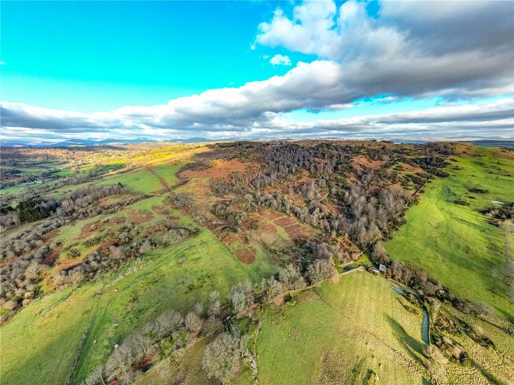
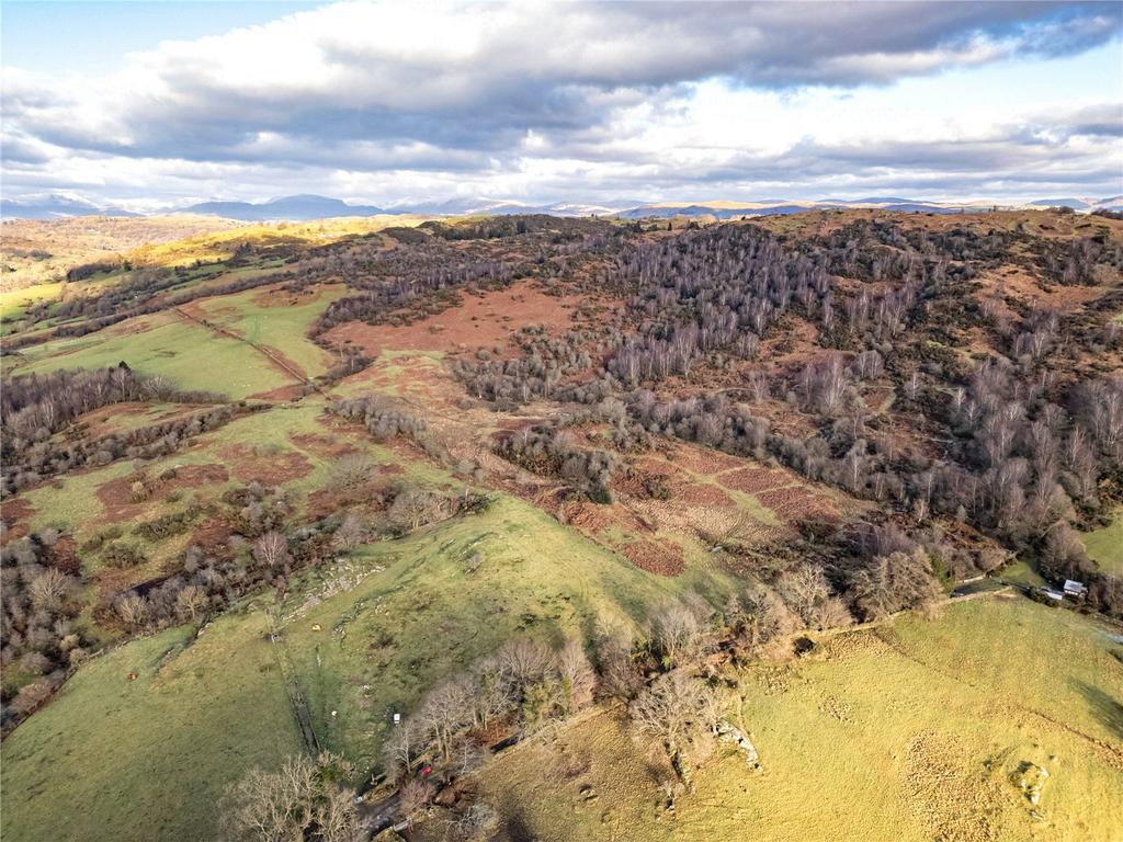
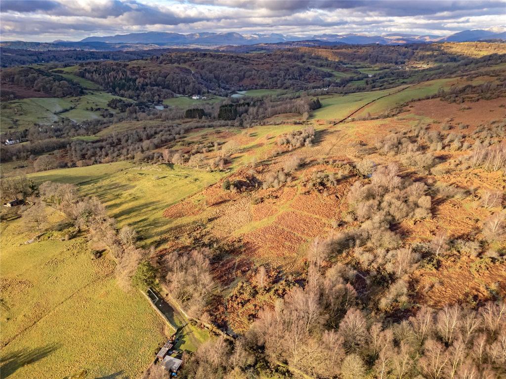
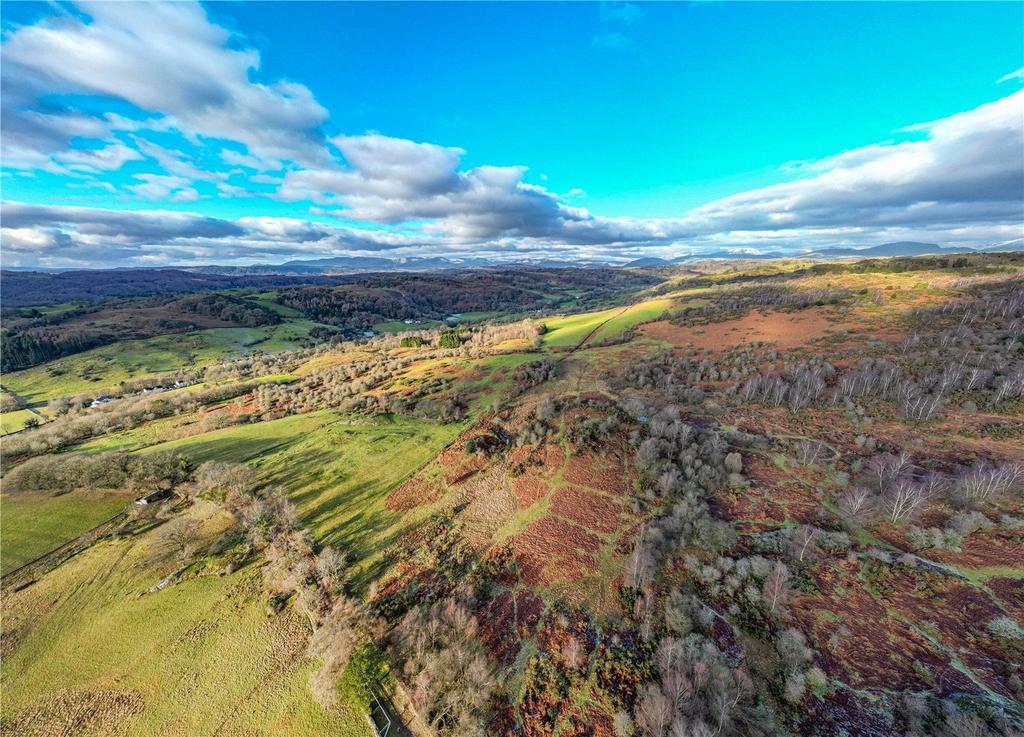
- Spectacular views of the Winster Valley & Lakeland Fells
- High biodiversity and nature interest
- High amenity and sporting value
- Potential for wood pasture scheme and Biodiversity Net Gain units
- Only four miles from Windermere and Kendal
- Within the Lake District National Park [a UNESCO World Heritage Site].
An extremely attractive block of grazing and amenity land extending 162.12 acres (65.61 hectares) with spectacular views, situated close to Crosthwaite within the Lake District National Park (a UNESCO World Heritage Site).
Available in two separate Lots or as a Whole
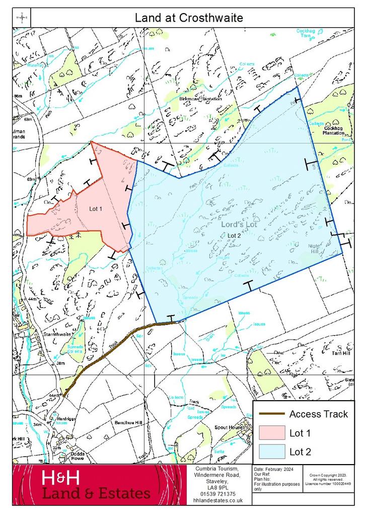
Lot 1 – 25.77 acres (10.43 hectares)
Lot 2 – 136.35 acres (55.18 hectares)
Lot 1
A ring-fenced block of productive upland meadow and grazing land with sporadic tree and shrub cover, divided into three separate parcels. The boundaries are a mixture of dry-stone walls and stock fencing. The land slopes gently upwards from the road entrance.
The land benefits from direct access from the adjacent Council maintained public highway. The land in parcel SD 4392 6470 is subject to third party rights of access granted for agricultural purposes to neighbouring fields.
Lot 2
A fantastic block of upland pasture extending to 136.35 acres (58.18 hectares). The allotment rises from west to east from approximately 55m above sea level at the entrance to the peak of Lord’s Lot at 205 above sea level. It offers spectacular views over the Winster Valley and towards the Lake District Fells.
The land can be accessed by vehicle via a stoned shared access track marked brown on the Sale Plan or via Lot 1 if purchased together. There is a public footpath crossing the land and the whole parcel is designated as open access land under the Countryside Rights of Way Act 2000.
The land comprises species-rich grassland and scrub with good amounts of heather and bilberry. It has some rocky outcrops and has been identified by Natural England for its fritillary butterfly. It is high in biodiversity and nature conservation interest but is not subject to any statutory environmental designations.
The land offers great sporting potential, with sporting rights included on both lots. The land has previously been used for pheasant shooting, clay pigeon shooting and deer stalking but there are no existing agreements in place.
Directions
From the centre of the village of Crosthwaite head west along Totter Bank, then take the turning on the right onto Rickettrea, signposted Crook and Starnthwaite. Continue for approximately 400m, then take the right hand fork, continuing to follow signs to Crook and Starnthwaite. After approximately 150m the stone track providing access to Lot 2 can be found on the right (with Lot 2 situated approximately 550m along this track on the left). For Lot 1 continue along the public highway for approximately 0.5 miles and the land can be found on the right denoted by the Selling Agent’s sale board.
Location
The land is situated to the north of the village of Crosthwaite in South Cumbria. It is approximately four miles west of Kendal and four miles east of Windermere.
Grid Reference: SD434926
What3Words: Flamed.Sudden.Reinvest
Services
Tenure/Possession
Freehold. Vacant possession on completion.
Services
Both Lot 1 and Lot 2 have natural water supplies.
Wayleaves and Easements
The properties are sold subject to and with the benefit of any existing easements, rights, wayleaves and rights of way whether or not specifically mentioned in these particulars.
Stewardship Schemes
The land is in the vendor’s Sustainable Farming Incentive Agreement but will be removed from this as soon as possible on completion of the sale. It is not subject to any other environmental schemes at present but would lend itself to Countryside Stewardship and in particular, the wood pasture option. Preliminary discussions have been had with Natural England about this.
Boundaries
As far as the vendor is aware the responsibilities for the boundaries are shown on the sale plan by an inward or outward facing “T” mark. Where no mark is shown, no further information is available.
Sporting Rights
The sporting rights are included with the property insofar as they are owned by the Vendor.
Mineral Rights
The mines and minerals are excepted from Lot 1. Mineral rights are included with Lot 2 insofar as they are owned by the Vendor.
Sale Plans
The Sale Plan has been prepared by the Selling Agent for the convenience of the prospective purchasers. It is deemed to be correct, but any error, omission or misstatement shall not affect the sale. Purchasers must satisfy themselves as to accuracy.
Planning Authority
Lake District National Park. Tel [use Contact Agent Button]
Method of Sale
The property is offered for sale by private treaty.
Viewing Arrangements
Viewing is permitted at any reasonable time with possession of a set of these particulars. Anyone viewing the land does so at their own risk and is politely asked to ensure that the gates are securely closed when leaving the land. Tel [use Contact Agent Button], Option 3.
About this agent

H&H Land & Estates are one of the Norths leading property experts. We are an independent Estate, Lettings and Land Agents with an extensive heritage offering a depth of knowledge and experience unrivalled in the local markets. This combined with our comprehensive range of services for buyers, sellers, landlords and tenants ensures our offices are the first port of call for clients across Cumbria, Durham, North Yorkshire and the Scottish Borders.


