Land for sale
Key information
Features and description
- Tenure: Freehold
- Approximately 0.95 acres (0.38ha) of amenity land
- Strategic location within Undy
- Excellent accessibility
- Close to local amenities
- Benefitting from previous planning permission for residential development
Rooms
DESCRIPTION
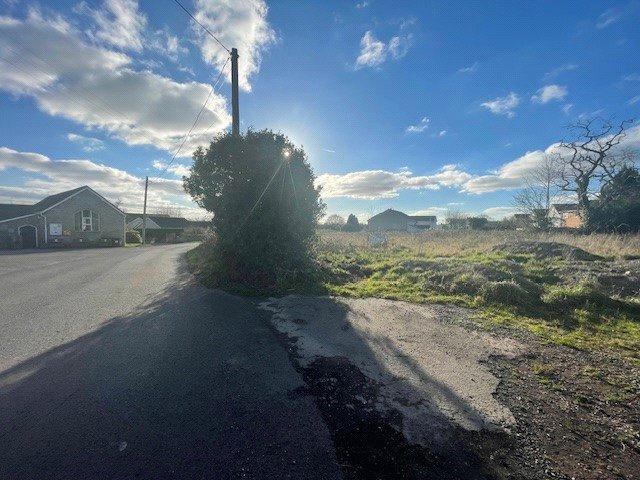
The property comprises a prime development opportunity within the popular village of Undy. The site includes a level lying block of bare amenity land extending to approximately 0.95 acres (0.38 Ha).
The land benefits from direct roadside access onto Church Road. The land is situated between existing built residential development and is located within the Village Development Boundary.
LOCATION
The site is located south of Undy, an expanding village conveniently located just off the B4245 and well connected to other major road networks including the Junction 23 of the M4 motorway as well as the M48 and M5 motorways corridors.
These connections provide efficient routes to key cities including Newport, which is 11 miles distant, Cardiff at 22.3 miles and Bristol approximately 23.8 miles away.
DIRECTIONS
When heading east from Magor, continue along the B4245 approximately 1 mile before taking the right hand turn onto The Ramp. After passing Undy Football Club, at the crossroads turn left onto Church Road. Continue approximately half a mile where the property can be found on your left-hand side, immediately opposite St. Mary’s Church and Undy Village Hall.
When using the mobile application What 3 Words ///: fully.swarm.brush
SERVICES
Potential purchasers should make their own enquiries as to location and costs of connections to mains services although all mains’ services are believed to be readily available.
PLANNING
The land has historically approved planning for the erection of six dwellings with garages and associated works. This permission has now expired however we would recommend interested parties make enquiries with the Local Planning Authority.
Details of the historic planning permission is available on Monmouthshire County Councils website under Planning Reference DC/2007/01277.
EASEMENTS, COVENANTS & RIGHTS OF WAY
The property is sold subject to any rights, benefits or incidents of tenure which affect it. A footpath runs along the northwestern boundary of the land to the recreational grounds to the rear (Ref 372/1/1).
TENURE
Freehold with vacant possession upon completion.
ACCESS
The land is accessed directly off Church Road which adjoins the B4245.
Property information from this agent
About this agent


