Popular
Total views: 500+
Offers over
£975,000Land for sale
Lot 2 - Broughdearg Hill, Glenshee, Blairgowrie, PH10
Featured
Land
884.00 acre(s)
Key information
Tenure: Freehold
Council tax: Ask agent
Features and description
- Tenure: Freehold
- About 884 acres in total
- Potential for a native woodland scheme
- Potential to generate carbon units through the woodland carbon code
- Telecoms mast generating some additional income
- Set within the Cairngorms National Park
- Parts of the hill attract red deer
Lot 2 - Broughdearg Hill
Description
Lot 2 - Broughdearg Hill
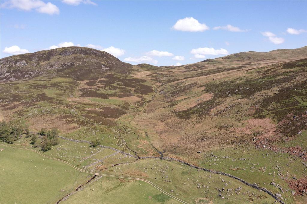
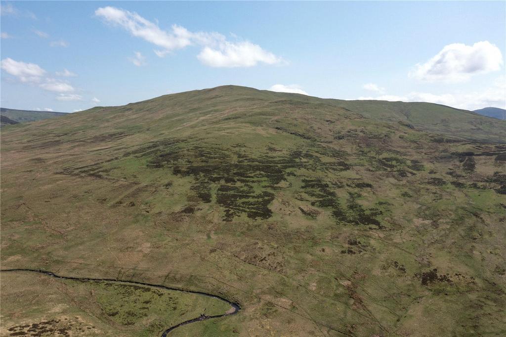
Broughdearg Hill adjoins Lot 1 to both the north and east from where it gently rises to the highest point – Duchray Hill – which peaks at 702 metres above sea level. From Duchray Hill there is a ridgeline which runs to Meall an Ruighe and beyond to Creag na Bruaich forming a natural, sheltered and south westerly facing bowl. On the northern side of the ridge the land continues and gently falls away to the most northern boundary of Broughdearg, the Allt Mor Burn.
Given the natural topography and aspect of the land there is excellent potential for woodland creation at Broughdearg. There are no conservation or environmental designations over the land and the Cairngorm National Park Forest Strategy, along with other objectives, “promotes the creation of new woodlands”. If trees were to be planted they could potentially generate carbon units through the UK Woodland Carbon Code, the British standard for climate change mitigation afforestation projects. The Timber Transport Forum classifies the A93 as an Agreed Route for timber extraction.
In recent years the vendors commissioned surveys and in 2022 submitted a planting application to Scottish Forestry for a mixed native and commercial planting scheme. The planting scheme was approved in October 2023 and comprised 112HA of Scots pine, 16HA of native upland birch and 10HA of native low density woodland on the outer edge of the scheme. Whilst the scheme was approved and a contract was issued at the time, this was not signed and it has now expired, enabling an incoming purchaser to potentially reactivate the proposed scheme or alternatively create a new plan.
Sheltered pockets of the hill attract a small number of red deer during the autumn and winter months providing some sporting opportunities at Broughdearg when conditions and seasons allow.
TELECOMS MAST There is a telecoms mast which is located to the north of the proposed house site (Lot 1). The mast is currently leased to CTIL (Cornerstone Telecommunications Infrastructure Limited) until 29th October 2027. The mast g nerates a rent of £7,099.31 per annum. A copy of the lease is available from the Selling Agents.
Location
Broughdearg lies in Glenshee in Highland Perthshire, a county renowned for its wonderful and varied landscapes which include tranquil river banks, productive farmland and rolling heather moors. Broughdearg lies almost equidistant between Blairgowrie (16 miles) and Braemar (17 miles) in Royal Deeside. Known as the gateway to Glenshee, and locally as ‘Blair’, Blairgowrie (16 miles) has an excellent selection of local shops and is the centre for the Perthshire soft fruit growing industry. The Dalmunzie Castle Hotel is located approximately 4.5 miles from Broughdearg and provides both dining and accommodation.
The highland village of Braemar, which lies 17 miles to the north, is particularly popular with tourists with its world famous Highland Gathering held annually in September, and the recently refurbished Fife Arms – a boutique 5 star hotel situated in the heart of the village.
The larger regional centres of Perth (32 miles) and Dundee (35 miles) are within easy reach and offer a range of professional services, shops, cultural and leisure facilities. Dundee Airport offers flights to and from London Heathrow and Belfast. Perth Airport at Scone (30 miles) can accommodate small private aircraft. There are mainline railway stations in both Perth and Dundee which connect to Edinburgh and the south.
There is an abundance of sport and leisure attractions available locally including the extensive downhill ski centre at Glenshee (9 miles), mountain biking trails, salmon fishing on the rivers Tay and Ericht, championship golf courses at Rosemount (Blairgowrie), Carnoustie, Gleneagles and St. Andrews, together with hill walking and traditional field sports in the Cairngorms National Park.
Acreage: 884 Acres
Directions
Broughdearg is situated off the A93 which connects Blairgowrie and Braemar. From the south, head north from Blairgowrie following the A93 through Bridge of Cally. Continue on the A93 for approximately 10 miles and turn right at the signpost for Broughdearg. From the north, head south on the A93 past Glenshee Ski Centre and the Spittal of Glenshee. Continue on the road for a further 8.5 miles and turn left at the signpost for Broughdearg.
For sat nav purposes the postcode is PH10 7QB.
what3words - ///riverside.ranted.enhances
About this agent

It pays to specialise in a property market as broad as the one served by Savills Edinburgh. From prime commercial offices and out of town retail parks to the
cream of city property, to country houses and sporting estates, the choice is as large and varied as the area we cover. That’s why we have dedicated teams
specialising in prime residential property, farms and estates, land sales, commercial property, valuation and planning, right across the full property spectrum.


