Offers in region of
£480,000Land for sale
Land to the West of Rhosygadfa, Gobowen
Land
Key information
Features and description
- Tenure: Freehold
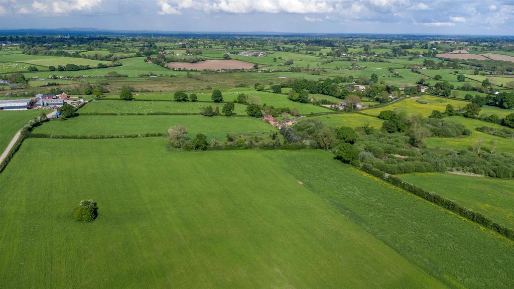
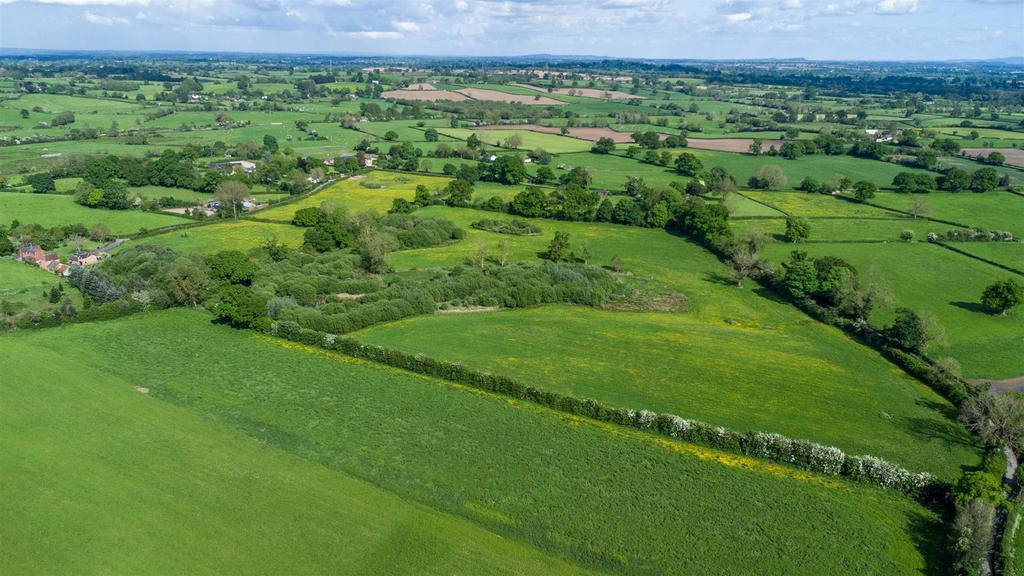
The Land to the West of Rhosygadfa is 43.447 acres (17.582 ha) of grassland. We are favoured with instructions to bring to the market this very versatile area of farmland. The land is currently down to a short term grass ley but equally suitable for a range of cropping options such as arable and root crop. It is also suitable for a range of uses such as amenity land, carbon and emerging environmental schemes of particular interest. The land currently benefits from full organic status and has been farmed organically for over 25 years. The land is well established with boundaries and can be accessed through 4 entrances. Currently the land is within a Countryside Stewardship Mid-Tier scheme which ends December 2024.
Permitted development has been approved by Shropshire Council - 23/04695/AGR for an agricultural storage building of 247.05 sq metres . Full plans can be seen on Shropshire Council Website. Available as a whole or in 4 separate lots.
Description - The Land to the West of Rhosygadfa is 43.447 acres (17.582 ha) of grassland. We are favoured with instructions to bring to the market this very versatile area of farmland. The land is currently down to a short term grass ley but equally suitable for a range of cropping options such as arable and root crop. It is also suitable for a range of uses such as amenity land, carbon and emerging environmental schemes of particular interest. The land currently benefits from full organic status and has been farmed organically for over 25 years. The land is well established with boundaries and can be accessed through 4 entrances. Currently the land is within a Countryside Stewardship Mid-Tier scheme which ends December 2024.
Permitted development has been approved by Shropshire Council - 23/04695/AGR for an agricultural storage building of 247.05 sq metres . Full plans can be seen on Shropshire Council Website. Available as a whole or in 3 separate lots.
The land is currently leyed to a short term grass ley used for grazing animals and silage production. The land is reasonably flat. To the East of the land there are ponds are situated providing a natural water source and haven for wildlife. Main access is gained into the land at the south of the property through a single track and gateway, along with 3 other entrances.
Boundaries - Any purchaser shall be deemed to have full knowledge of all boundaries and neither the Vendor nor the Vendors Agents are responsible for defining the boundaries or ownership thereof.
Mineral Rights - Included within the sale.
Sporting Rights - Included within the sale.
Public Rights Of Way - There is a public right of way present on this property, crossing from West to East, to the North of the land.
Location - The land is situated to the West of Rhosygadfa, 1.7 miles from Gobowen and 4.6 miles from Oswestry all distances are approximate.
Wayleaves, Rights & Easements - The land is sold subject to all existing wayleaves and purchasers must satisfy themselves as to the routes thereof.
The land is sold subject to and with the benefit of all rights including private and public rights of way, sewage, water, gas and electricity supply, light, support and any other easements.
Tenure And Possession - Freehold. Vacant possession will be given on completion subject to contract.
Viewing - Viewing must be undertaken on foot in daylight hours prior to arrangements with Roger Parry and Partners. A set of particulars must be carried at all times when conducting the viewing. Please be aware of potential hazards on the land when viewing.
Local Authority - Shropshire County Council, Shirehall, Shrewsbury, SY2 6ND
Method Of Sale - Land to the West of Rhosygadfa is offered for sale by Private Treaty. Prospective purchasers should register their interest with selling agents to who offers should be submitted.
Offers - Offers are invited in excess of £480,000
What Three Words - Picture.tightrope,tops
Property information from this agent
About this agent

Roger Parry & Partners - Oswestry
The Estates Office, 20 Salop Road
Oswestry, Shrewsbury
SY11 2NU
01691 721940As estate agents and chartered surveyors our specialism is property. We have a strong presence in the residential, agricultural and commercial sectors. We have a highly successful planning and development team offering a complete service backed by wide experience. Established in 1981, the residential team have over 200 years of collective experience, providing a wealth of knowledge relating to the area, local amenities and facilities, along with details on any potential developments. We pride ourselves in being a team who are passionate about what we do, we are always willing to go that extra mile and provide first class service. If you are considering selling your home, at Roger Parry and Partners we believe your home is your most valuable asset and choosing an Estate Agent to sell your home is a very important decision which cannot be taken lightly. Please contact us today to discuss the range of services we can offer.


