


 Floorplan
Woodland
Key information
Features and description
- Ancient Woodland
- Over 11.5 acres
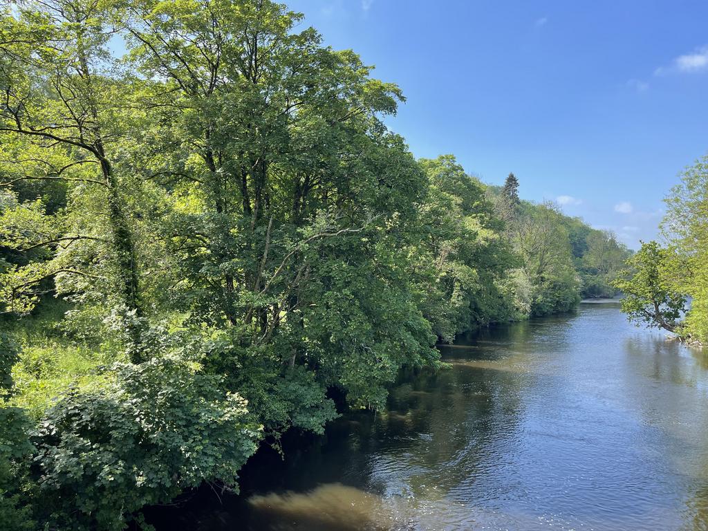
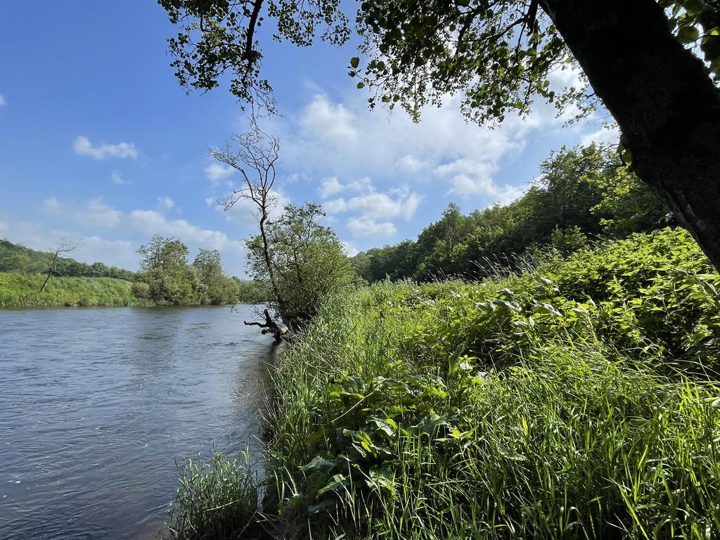
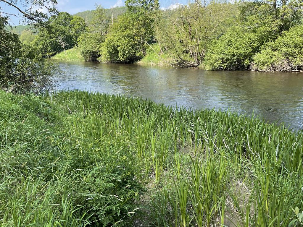
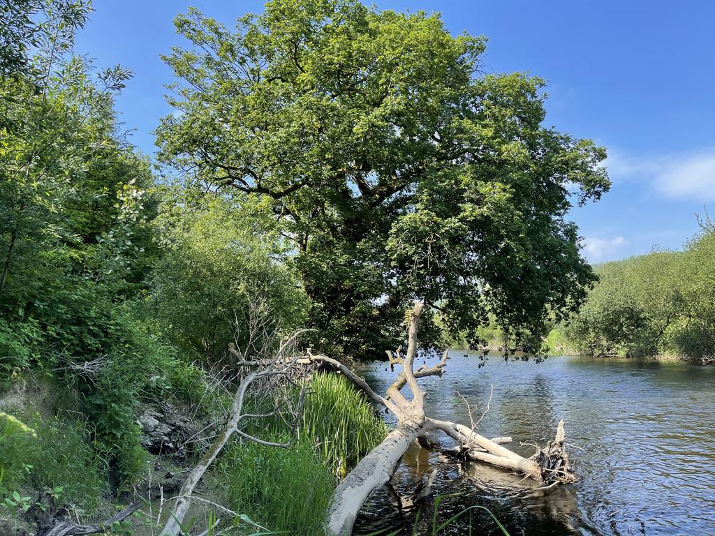
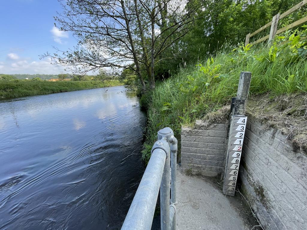
- Long River Teifi frontage and riverbed
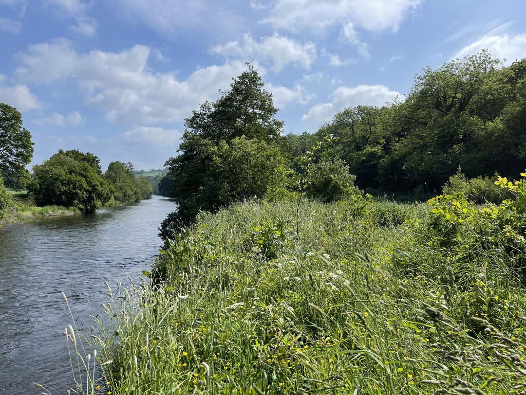
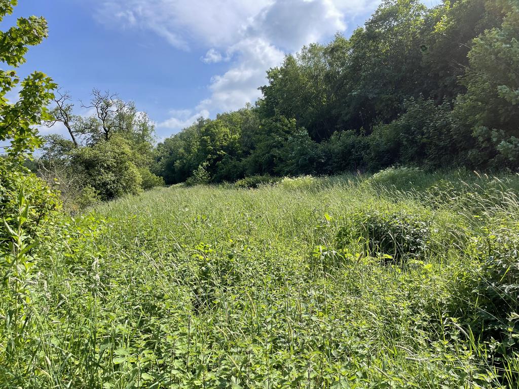
- Riverside meadow
* * * PRICE NOW REDUCED TO £125,000 * * *
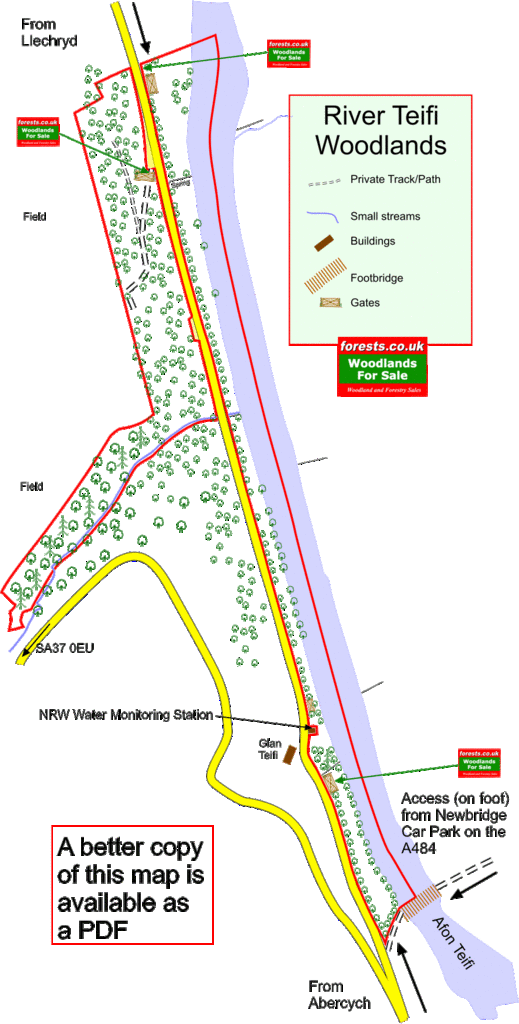
River Teifi woodlands are a unique and beautiful stretch of the Teifi valley, running either side of a minor road from Abercych to Llechryd, including a long frontage to the river, and the river bed to the mid-point.
The land is made up of
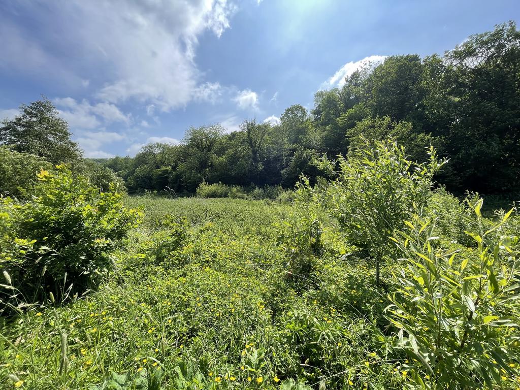
- 3¼ acres of riverside meadow, mainly grassland, but lined with trees, and with a range of younger trees, especially willow, being encouraged to grow.
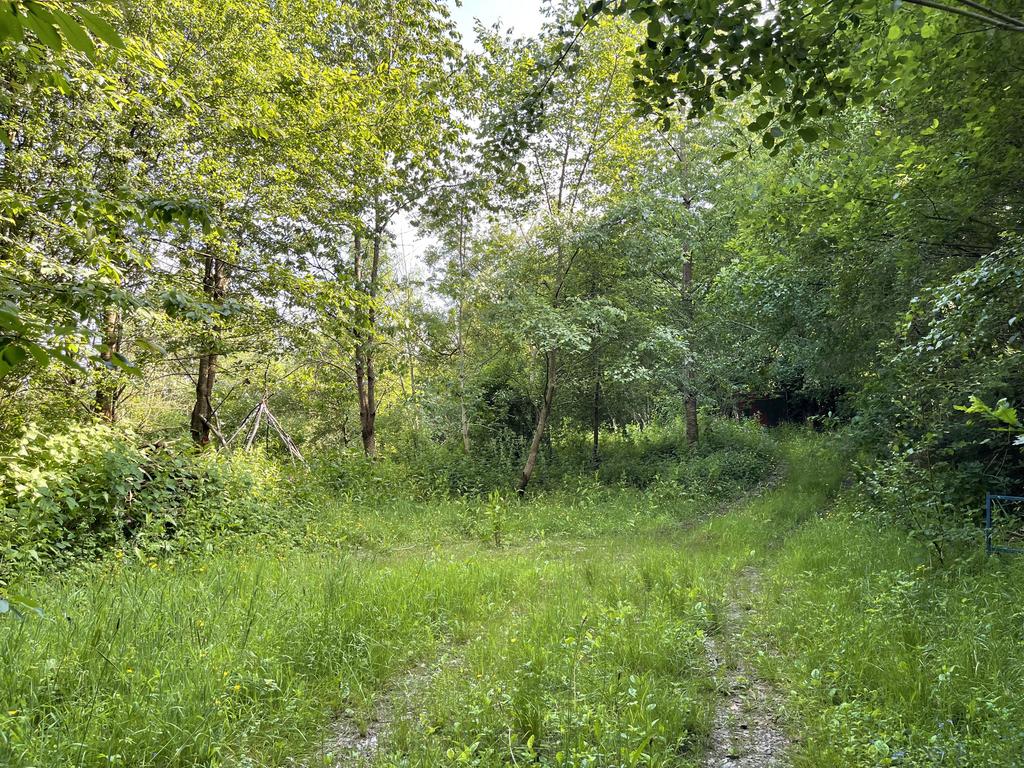
- 5¼ acres of mixed woodland, mostly broadleaf, but with a smattering of mature conifers, and a small stream
- 3¼ acres of the Afon Teifi riverbed
The riverside meadow/riparian woodland is flat throughout, with just the western edge sloping up sharply to the road level.
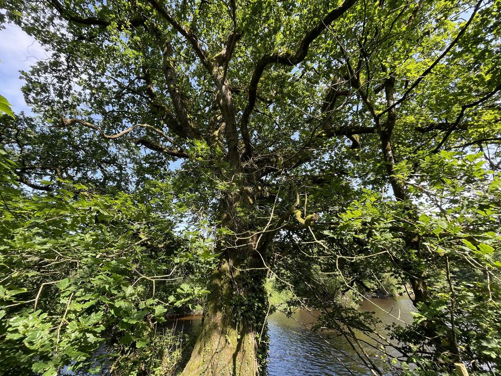
The meadow has been managed following permaculture principles combining tree planting of young oak, 3 types of willow (weaving and biofuel species), poplar and a damson. Natural regeneration of native trees has also been part of the plan alongside the care of the mature trees especially the two ancient oaks and the white fir. Wild food and materials are in abundance here and within the woodland.
The woodland is designated as Ancient Woodland. It is on record at the moment as a Plantation on an Ancient Woodland Site, but although there are mature conifers, they are widely spread, and it really isn’t a conifer plantation any more, as most of the conifers were felled 1997. It slopes up from the road, but is much more level towards the western boundary.
The woodland is a mixture of Oak, Wild Cherry and Silver Birch, Hazel, Holly, Hornbeam, Hawthorn, Ash, Willow, Sycamore, Elm, Rowan, and Crab and domesticated Apples, with Oak and beech around the boundaries. It would be well suited to coppicing
The stream at the southern end of the wood is in a fairly steep-sided valley, and the woodland slopes away quite steeply from the fence line down to the stream along its length. A south-facing steep slope that is relatively clear of trees was earmarked by the current owner for terracing, as it would provide an ideal location for growing food, and this could be a project for a new owner. There is a hint of a path near the fence line leading through the southern “spur” of the wood, and it is a lovely area for the more sure-footed to explore. A broad spectrum of woodland mushrooms and fungi are to be discovered throughout the seasons.
Boundaries: The woodland: the minor road is the eastern boundary of the woodland. The western boundary is fenced from adjoining farmland. The short northern boundary is an earthbank
The southern boundary is the far side of the stream for most of its length, but is also marked by earth works in the upper spur.
The riverside meadow: the eastern boundary is the mid-point of the river. The western boundary is the minor road. The short northern and southern boundaries are fenced.
Wildlife: The wood is alive with the sounds of birds, including wren, song thrush, blackbird and chiffchaff, blackcap, chaffinch and long-tailed tit. Otters are often witnessed from and in the meadow, brook lamprey are found in the shallows and the present owner has been informed that lamprey are recorded by the monitoring unit. This section of the river is part of a river wildlife restoration plan led by NRW.
River monitoring station: Natural Resources Wales own a small monitoring station near the southern end of the land, and they have a right of access to the river at that point, and the current owner has developed a good working relationship with NRW.
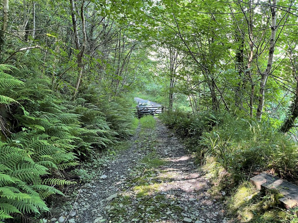
Access: A good stoned track, suitable for any vehicle, leads straight from the road up through the woodland to a level parking and turning area. A now overgrown track runs back along the wood for most of its length to the north. A neighbouring organic farmer has a right of way over the track, but this has not been exercised for many years.
The riverside meadow is accessible via gateways at opposite ends of the land. The northern access has a small stoned hard standing, a larger proportion is natural and purposely allowed to re-generate. The southern access is into a small self-contained meadow of two-thirds of an acre that could be used for grazing. There is also a small pedestrian gate just to the north of the NRW river monitoring station.
Sporting rights: Included, with the exception of the fishing rights, which are privately owned by a neighbour.
Mineral rights: Included, except as excluded by statute.
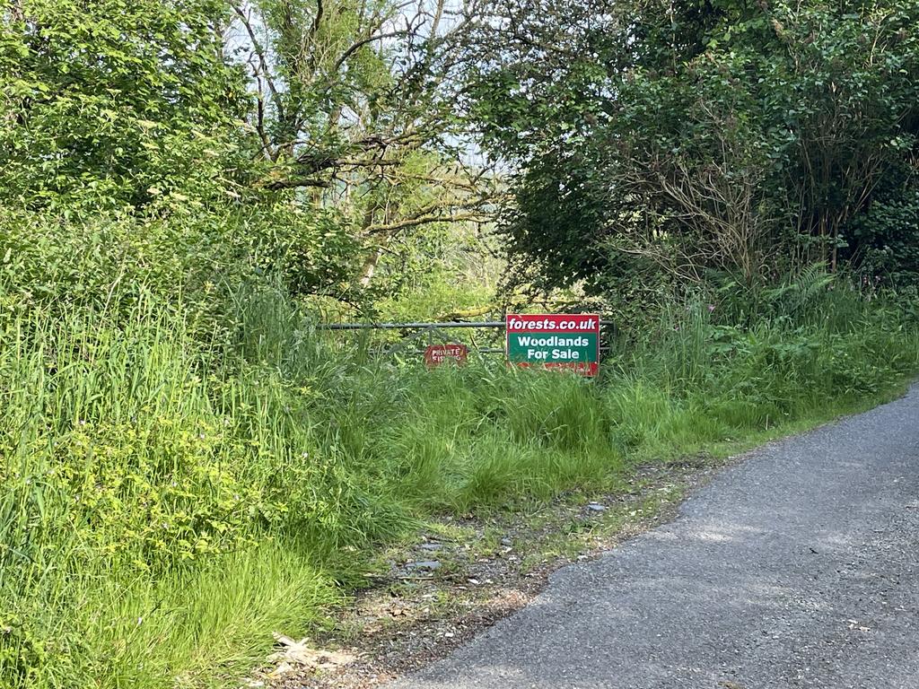
Public footpaths: There are no public footpaths or public access of any kind within the land.
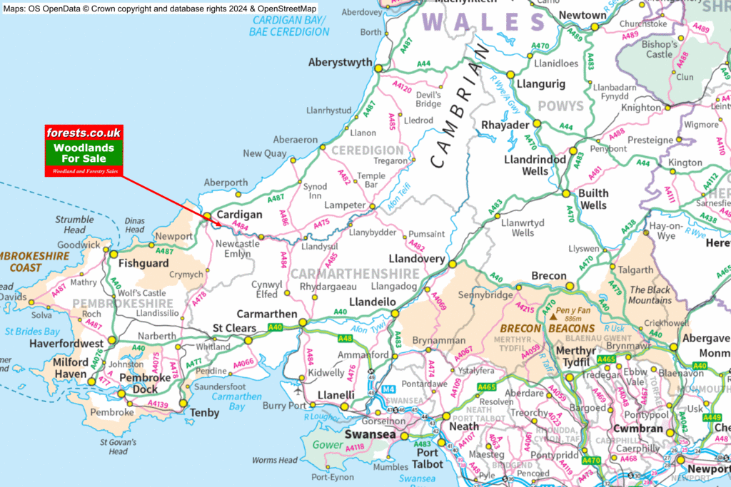
Local area: The woodland is just two miles from Llechryd, and five miles from Cardigan. The Teifi Marshes Nature Reserve is six miles away. Cenarth, famous for the falls and Coracle making, is just three miles away. The village of Abercych has a respected history of both coracle making and wooden turned work.
Photographs: were taken in May 2024
VIEWING: You are welcome to visit this wood by yourself. Please ensure that you have a copy of these sales details with you: we recommend either printing the details or downloading them to your phone/tablet/laptop before you go. Please take care when viewing as the great outdoors can contain unexpected hazards and woodlands are no exception. Make sure you take a copy of the sales particulars with you, as there may be no mobile signal at the woodland.
A PDF version of the Wood Map is available to download
Directions
Depending on where you are coming from, the woods can be approached:
from the south-east, via the B4332 Boncath to Cenarth road
In Abercych, take the turning in the middle of a sharp bend, signposted Llechryd and Cilgerran
Follow this road for just under one mile.
Take a right fork, un-signposted apart from a warning “Unsuitable for long vehicles”.
When you see the house called Glanteifi, the riverside meadow is on your right hand side. The best place to park is in the entrance to the wood, half a mile further along, on the left side of the road.
from the north-west via Llechryd.
In Llechryd, cross the bridge to the south side of the river, and immediately take a left turn, un-signposted apart from a warning “Unsuitable for long vehicles”.
Follow this road for two miles, and the entrance to the woods will be on your right.
If following SatNav
SatNav based off postcode is not very helpful for navigating to the wood, as there is no postcode that will take you along the right road. The best postcode to use is SA37 0EU – but
- if coming through Abercych, half a mile before the destination take a right fork, signed as unsuitable for long vehicles. Follow this road for half a mile. When you see the house called Glanteifi, the riverside meadow is on the right hand side
- if coming via Llechryd, turn left immediately after crossing Llechryd bridge, and continue for two and a half miles.
- If coming via Boncath, do not turn off the B4332 just after leaving Boncath. Stay on the B4332 to Abercych, then follow the instructions above.
For the track leading into the woodland
- Coordinates: 52.04968,-4.56389
- What3Words: flashback.nuzzling.lamenting
For the gate into the meadow at the southern end:
- Coordinates: 52.04516,-4.56177
- What3Words: handed.vintages.insert
Please note: the particulars with plans, maps, descriptions and measurements are for reference only and although carefully checked we cannot guarantee their accuracy and do not form part of any contract. Any intending purchasers must satisfy themselves by inspection or otherwise as to the correctness of these particulars.