No longer on the market
This property is no longer on the market


 Floorplan
Land
Sold STC
Land
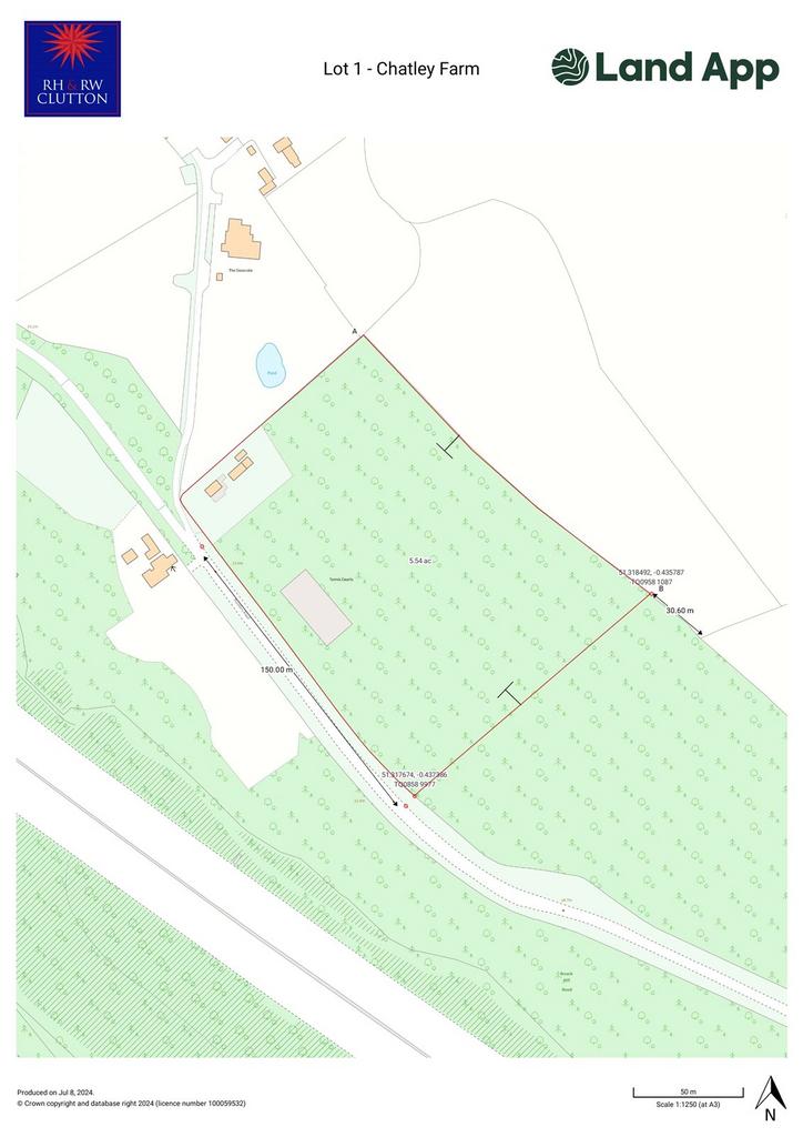
5.54 acre(s)
Key information
Tenure: Freehold
Council tax: Ask agent
Broadband: Ultra-fast 1000Mbps *
Mobile signal:
EEO2ThreeVodafone
Features and description
- An interesting mix of buildings and woodland available in 3 Lots or as a whole
- Ground surveys have been done and architects plans drawn up for 2 houses on Lot 1, but not submitted
- Metered mains water trough supply to part of land
- Access to a Bridle Path
Video tours
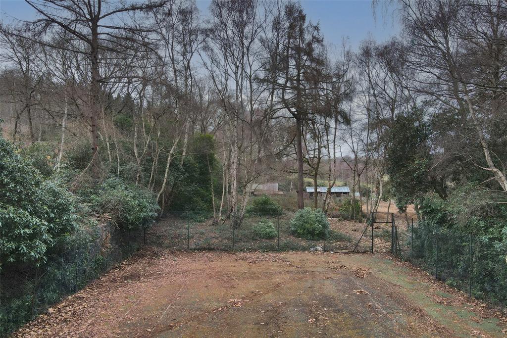
LOT 1 - 5.54 acres - The Buildings
AVAILABLE AS A WHOLE OR IN 3 SEPARATE LOTS
CONTACT : JAMES TILLARD
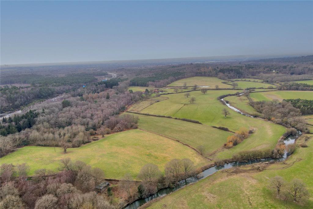
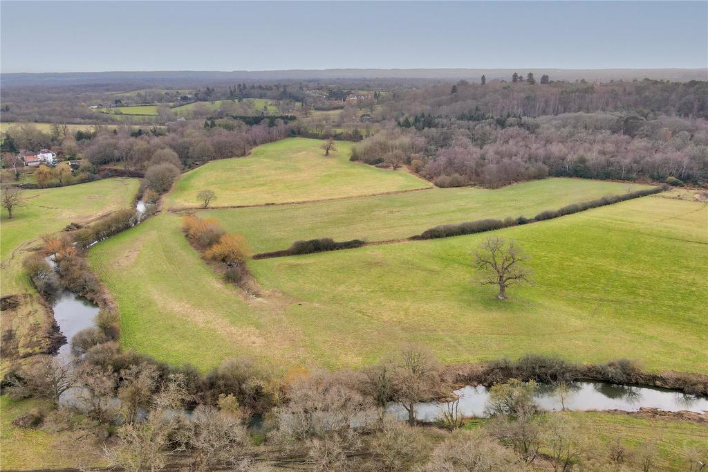
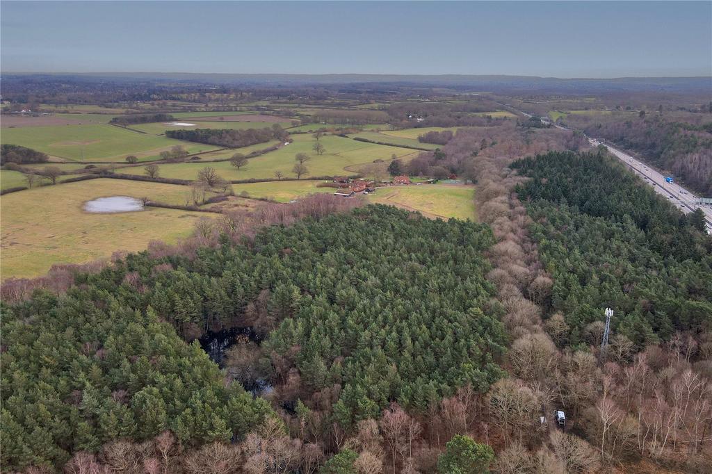
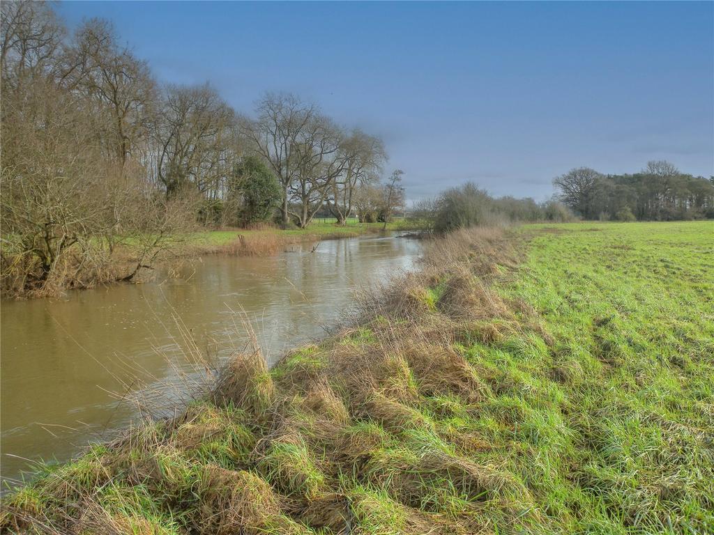
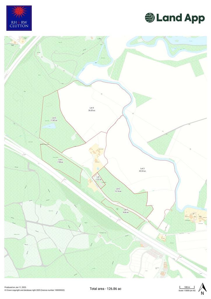
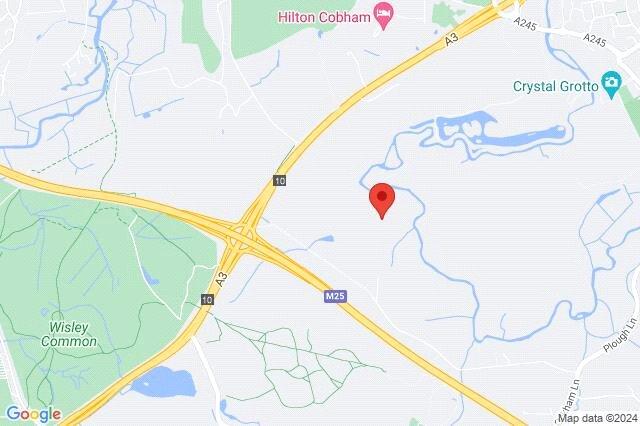
An interesting mix of buildings, farmland and woodland situated between the River Mole and the M25. In all extending to about 59.86 acres (24.22 ha). Available as a whole or in 3 lots.
SITUATION
The land lies immediately on the north side of the M25 on the east side of the junction with the A3. Cobham is 3 miles and just beyond Oxshott 6 miles. Guildford to the south is 12 miles and the M3 junction to the north about 10 miles.
DESCRIPTION
These interesting parcels lie between the M25 on the southern side and on the northern side the River Mole. The land is ideally located for a new owner to pursue outdoor leisure pursuits with the potential adventures on offer. Some of the land is shown susceptible to flooding. The land is offered as follows:
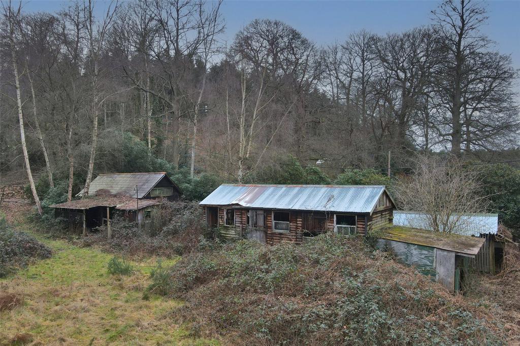
• Lot 1 – The Buildings 5.54 acres
An interesting little group of buildings with potential comprising a brick/timber and slate roof shed 7.45m x 3.25m with a lean to 4.6m x 3.0m and attached dilapidated store. Old stables, weatherboard and tin 8.5m x 3.5m with attached dog kennel. Small collapsing store. To one side is a derelict tennis court. Please see separate plan for amended boundary. Ground surveys have been done and architects plans drawn up for 2 houses on the site but not submitted.
SOLD • Lot 2 – Woodland 13.14 acres
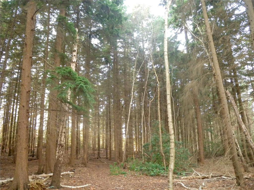
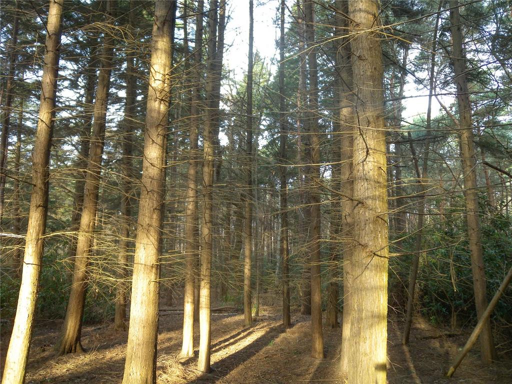
Ancient and semi natural broadleaf woodland with sycamore, chestnut and silver birch, ancient oaks and beech and an understorey of rhododendron. At the western end is a mature stand of larch and in the northern corner a wet bog area with aspen over. A few fine specimen Scots Pine tower over the ground.
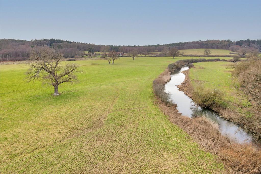
• Lot 3 – Pasture Land 45.54 acres
Having good lane access to an elevated part of the ground with a veteran field oak on the eastern side the land then falls down to the River Mole. In the south west corner is a small rewilded area.
• Lot 4 – Pasture Land 36.50 acres
A block of pastureland bordering the River Mole and sheltered to the south by woodland. The southern corner has been rewilded. Good access by a right of way off the lane along the southern boundary of Lot 5.
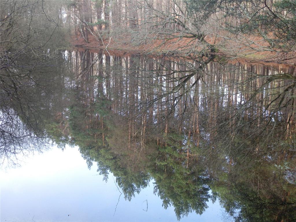
• Lot 5 – Woodland & Pond 17.82 acres
Predominately mature Scots Pine interspersed with oak, silver birch and chestnut. A large woodland pond provides added wildlife interest and on the eastern side there is a, partly open site with lapsed consent for a livestock building of 146 square meters.
WITHDRAWN • Lot 6 – Woodland 7.98 acres
An easily accessed small parcel principally mature Norway Spruce, Tsuga and Scots Pine with some silver birch and rhododendron. The eastern side is fenced for a dog day care running area. (Note the telecom mast site in the north western corner is excluded). Part directly adjoins the M25.
One small parcel (c. 0.74 ha) is subject to a CPO and further small areas are needed for temporary occupation for M25 improvement works.
SOLD • Lot 7 – Woodland 4.66 acres
Bordering Pointers Road this small parcel of principally mature Tsuga, also has a small pond, stands of silver birch and chestnut and also adjoins the M25.
VIEWING
Strictly by confirmed appointment only with the sole agents RH & RW Clutton –[use Contact Agent Button]/305825.
HEALTH & SAFETY
There are no immediate known risks except walking round the buildings where particular care must be taken, as there are open drains. Dogs must be kept on a lead.
TENURE & POSSESSION
The property is offered freehold with vacant possession on completion. The fishing rights are in hand.
RIGHTS OF WAY & WAYLEAVES
The property is sold subject to and with the benefit of all existing rights of way whether public or private, including rights of way, drainage, water and electricity supplies, covenants, restrictions and obligations and all wayleaves whether referred to or not.
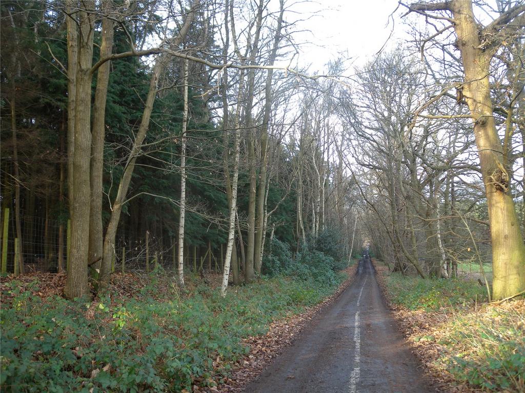
There are no public rights of way over the land – the public have access along the closed road west of Pointers Road, dividing the Lots, crossing over the A3. On the eastern side there is access onto a bridle path crossing over the the M25. Lot 4 is crossed by an overhead pylon line and includes 1 pylon.
Lot 4 has a right of way over the track on the east side of Lot 5 on the adjoining property.
SERVICES (Not tested and therefore not warrantied)
A metered mains water trough supply is laid on to part of the land.
TOWN & COUNTRY PLANNING
The property (not withstanding any description contained in these particulars) is sold subject to any existing Town & Country Planning legislation and to any development plan, resolution or notice which may be in force and also subject to any statutory provisions or by-laws without any obligation on the part of the Vendors or his Agents to specify them.
There are no current relevant issues affecting the land - consent for an agricultural livestock building 2009/1993 has lapsed.
The land on its western boundary directly abuts Chatley Heath an SSSI area of Common Land, and all lies within the Metropolitan Green Belt. On the northern boundary of Lot 4 lies the remnants of a late Roman Bath House listed as a Scheduled Monument.
BPS/GRANT SCHEMES
The land is not currently entered into any grant schemes.
PLAN
The plan and stated acreages in these details are for identification and information purposes only and potential purchasers must rely on their own investigations.
FIXTURES & FITTINGS
All fixtures, fittings and chattels whether referred to or not are specifically excluded from the sale, including all farm and stock related equipment.
SPORTING RIGHTS, MINERALS & TIMBER
These are included within the freehold in so far as they are owned.
LOCAL AUTHORITIES
Surrey County Council[use Contact Agent Button]
Elmbridge Borough Council[use Contact Agent Button]
Forestry Commission[use Contact Agent Button]
TERMS OF SALE
The Vendor will wish to retain a 40% overage over 25 years on any non-agricultural or forestry development on Lot 1.
DIRECTIONS (KT11 1PJ SatNav works)
On the Junction 10 roundabout take the south slip road on A3 to Guildford, but turn off left immediately into Old Lane, then left at the Black Swan crossroads into Oakham Lane, pass back over the motorway and turn left into Pointers Road and proceed down to the end.
AVAILABLE AS A WHOLE OR IN 3 SEPARATE LOTS
CONTACT : JAMES TILLARD
An interesting mix of buildings, farmland and woodland situated between the River Mole and the M25. In all extending to about 59.86 acres (24.22 ha). Available as a whole or in 3 lots.
SITUATION
The land lies immediately on the north side of the M25 on the east side of the junction with the A3. Cobham is 3 miles and just beyond Oxshott 6 miles. Guildford to the south is 12 miles and the M3 junction to the north about 10 miles.
DESCRIPTION
These interesting parcels lie between the M25 on the southern side and on the northern side the River Mole. The land is ideally located for a new owner to pursue outdoor leisure pursuits with the potential adventures on offer. Some of the land is shown susceptible to flooding. The land is offered as follows:
• Lot 1 – The Buildings 5.54 acres
An interesting little group of buildings with potential comprising a brick/timber and slate roof shed 7.45m x 3.25m with a lean to 4.6m x 3.0m and attached dilapidated store. Old stables, weatherboard and tin 8.5m x 3.5m with attached dog kennel. Small collapsing store. To one side is a derelict tennis court. Please see separate plan for amended boundary. Ground surveys have been done and architects plans drawn up for 2 houses on the site but not submitted.
SOLD • Lot 2 – Woodland 13.14 acres
Ancient and semi natural broadleaf woodland with sycamore, chestnut and silver birch, ancient oaks and beech and an understorey of rhododendron. At the western end is a mature stand of larch and in the northern corner a wet bog area with aspen over. A few fine specimen Scots Pine tower over the ground.
• Lot 3 – Pasture Land 45.54 acres
Having good lane access to an elevated part of the ground with a veteran field oak on the eastern side the land then falls down to the River Mole. In the south west corner is a small rewilded area.
• Lot 4 – Pasture Land 36.50 acres
A block of pastureland bordering the River Mole and sheltered to the south by woodland. The southern corner has been rewilded. Good access by a right of way off the lane along the southern boundary of Lot 5.
• Lot 5 – Woodland & Pond 17.82 acres
Predominately mature Scots Pine interspersed with oak, silver birch and chestnut. A large woodland pond provides added wildlife interest and on the eastern side there is a, partly open site with lapsed consent for a livestock building of 146 square meters.
WITHDRAWN • Lot 6 – Woodland 7.98 acres
An easily accessed small parcel principally mature Norway Spruce, Tsuga and Scots Pine with some silver birch and rhododendron. The eastern side is fenced for a dog day care running area. (Note the telecom mast site in the north western corner is excluded). Part directly adjoins the M25.
One small parcel (c. 0.74 ha) is subject to a CPO and further small areas are needed for temporary occupation for M25 improvement works.
SOLD • Lot 7 – Woodland 4.66 acres
Bordering Pointers Road this small parcel of principally mature Tsuga, also has a small pond, stands of silver birch and chestnut and also adjoins the M25.
VIEWING
Strictly by confirmed appointment only with the sole agents RH & RW Clutton –[use Contact Agent Button]/305825.
HEALTH & SAFETY
There are no immediate known risks except walking round the buildings where particular care must be taken, as there are open drains. Dogs must be kept on a lead.
TENURE & POSSESSION
The property is offered freehold with vacant possession on completion. The fishing rights are in hand.
RIGHTS OF WAY & WAYLEAVES
The property is sold subject to and with the benefit of all existing rights of way whether public or private, including rights of way, drainage, water and electricity supplies, covenants, restrictions and obligations and all wayleaves whether referred to or not.
There are no public rights of way over the land – the public have access along the closed road west of Pointers Road, dividing the Lots, crossing over the A3. On the eastern side there is access onto a bridle path crossing over the the M25. Lot 4 is crossed by an overhead pylon line and includes 1 pylon.
Lot 4 has a right of way over the track on the east side of Lot 5 on the adjoining property.
SERVICES (Not tested and therefore not warrantied)
A metered mains water trough supply is laid on to part of the land.
TOWN & COUNTRY PLANNING
The property (not withstanding any description contained in these particulars) is sold subject to any existing Town & Country Planning legislation and to any development plan, resolution or notice which may be in force and also subject to any statutory provisions or by-laws without any obligation on the part of the Vendors or his Agents to specify them.
There are no current relevant issues affecting the land - consent for an agricultural livestock building 2009/1993 has lapsed.
The land on its western boundary directly abuts Chatley Heath an SSSI area of Common Land, and all lies within the Metropolitan Green Belt. On the northern boundary of Lot 4 lies the remnants of a late Roman Bath House listed as a Scheduled Monument.
BPS/GRANT SCHEMES
The land is not currently entered into any grant schemes.
PLAN
The plan and stated acreages in these details are for identification and information purposes only and potential purchasers must rely on their own investigations.
FIXTURES & FITTINGS
All fixtures, fittings and chattels whether referred to or not are specifically excluded from the sale, including all farm and stock related equipment.
SPORTING RIGHTS, MINERALS & TIMBER
These are included within the freehold in so far as they are owned.
LOCAL AUTHORITIES
Surrey County Council[use Contact Agent Button]
Elmbridge Borough Council[use Contact Agent Button]
Forestry Commission[use Contact Agent Button]
TERMS OF SALE
The Vendor will wish to retain a 40% overage over 25 years on any non-agricultural or forestry development on Lot 1.
DIRECTIONS (KT11 1PJ SatNav works)
On the Junction 10 roundabout take the south slip road on A3 to Guildford, but turn off left immediately into Old Lane, then left at the Black Swan crossroads into Oakham Lane, pass back over the motorway and turn left into Pointers Road and proceed down to the end.
Property information from this agent
About this agent
RH & RW Clutton Property - East Grinstead
1 West Street
East Grinstead, West Sussex
RH19 4EY
01342 602911RH & RW Clutton is a long established independent company of land agents, chartered surveyors and estate agents, dealing with a wide range of property matters throughout the South East. We are one of the leading companies in the area and our expertise lies in the sale and letting of period houses and cottages, farms, land and woodland, as well as commercial property. We are enthusiastic and energetic in our approach and we aim to offer excellent service with a dedicated team focusing on achieving the best results for our clients.