Guide price
£950,000Land for sale
86 Acres Agricultural Land being formerly part of Trewrach Farm,, Dinas Cross, Newport
Land
86.00 acre(s)
Key information
Tenure: Freehold
Council tax: Ask agent
Features and description
- Tenure: Freehold
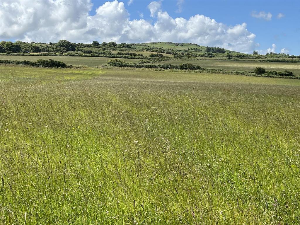
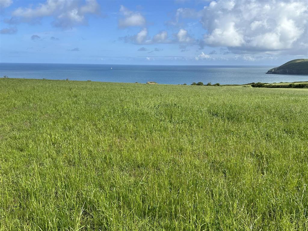
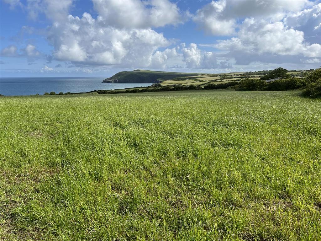
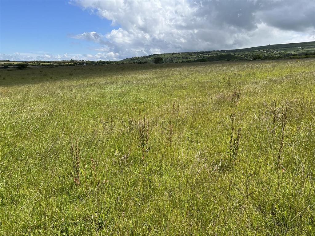
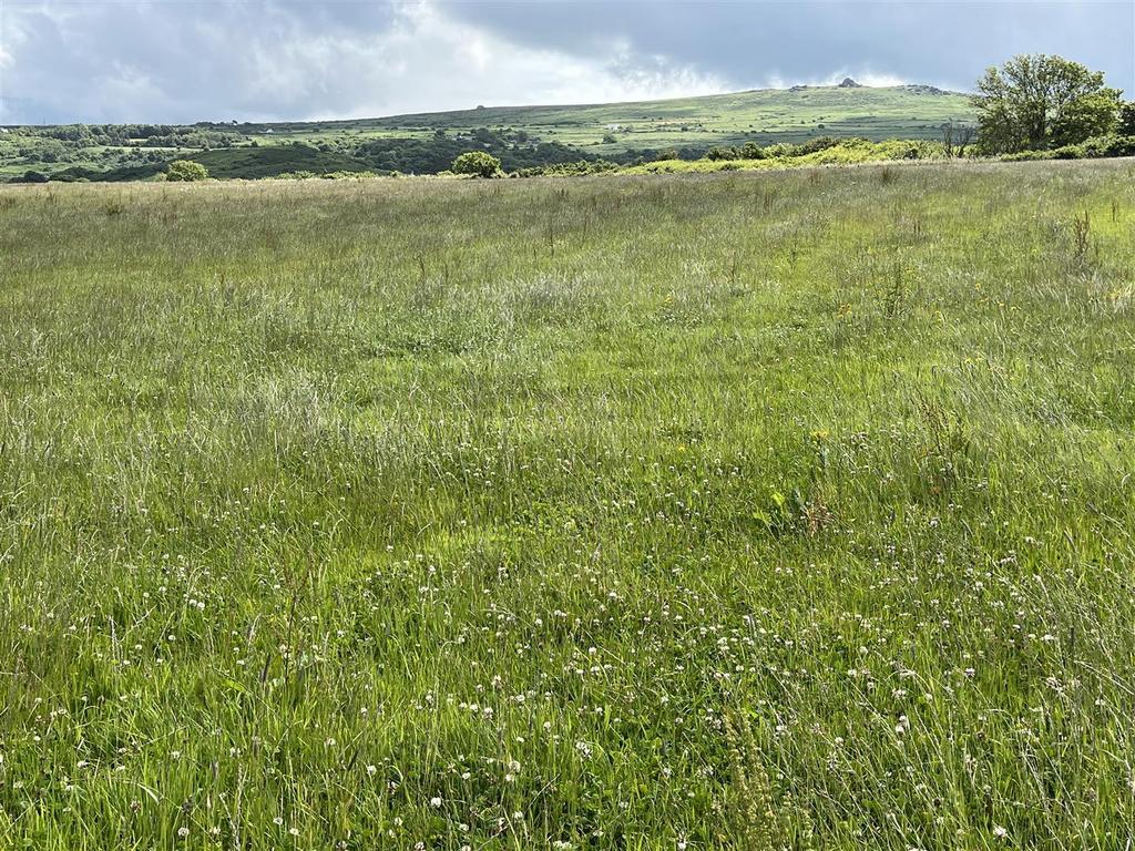
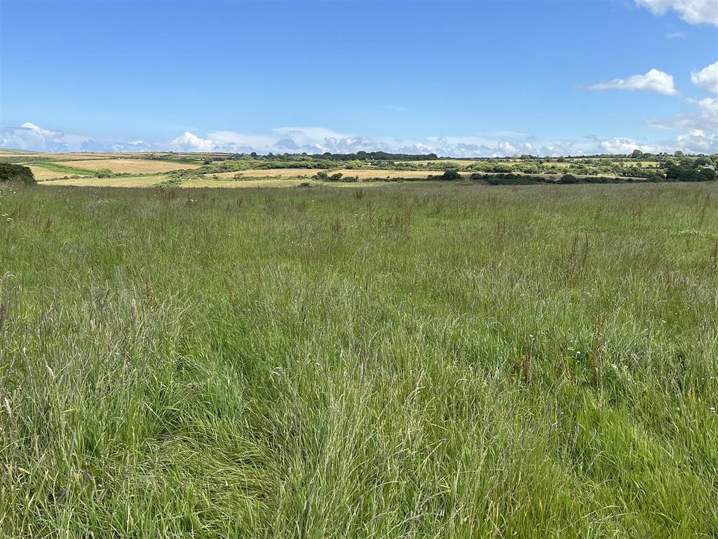
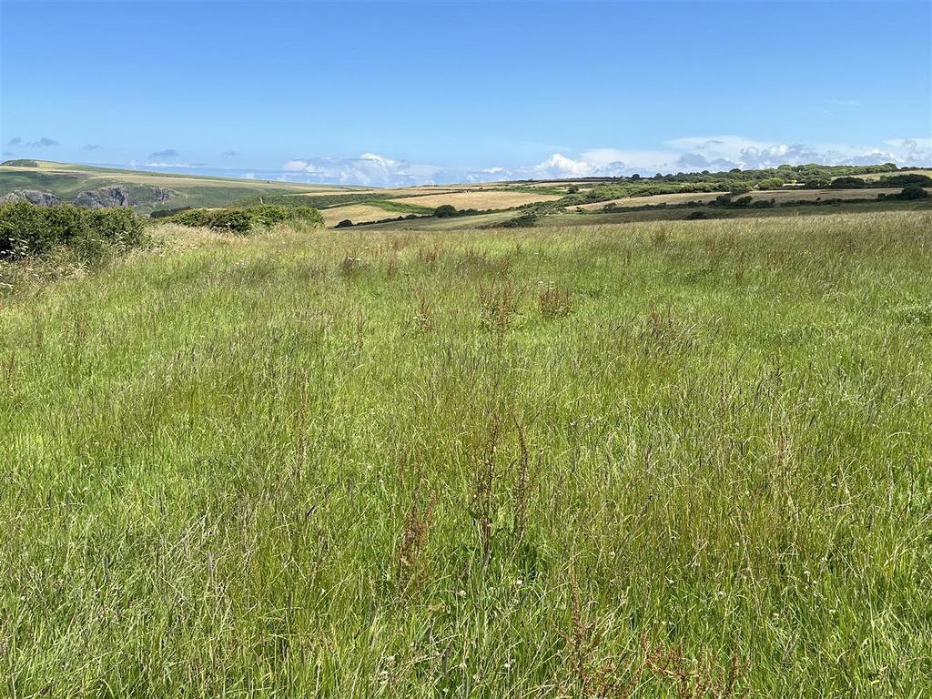
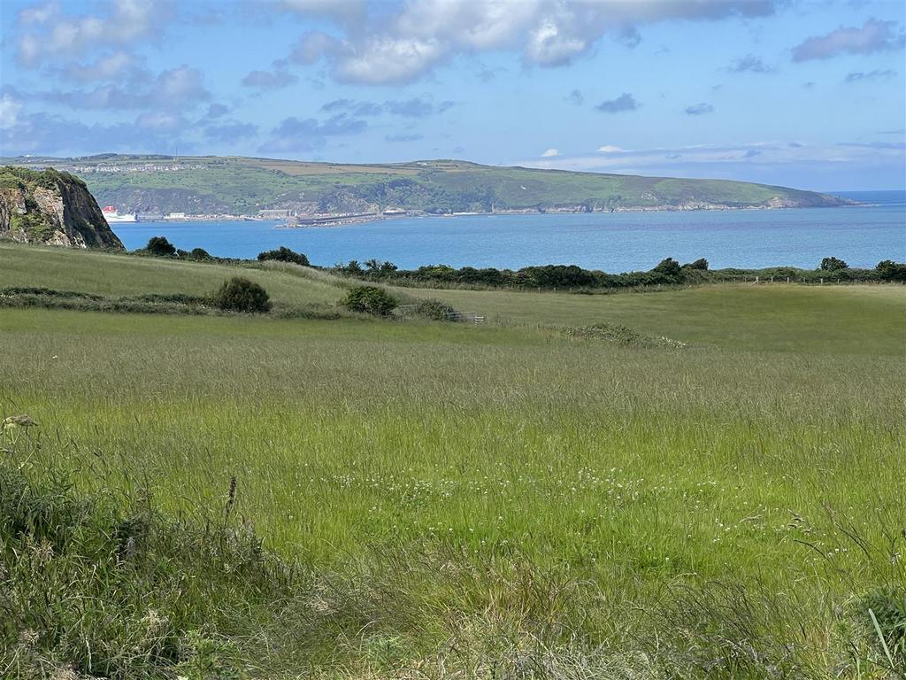
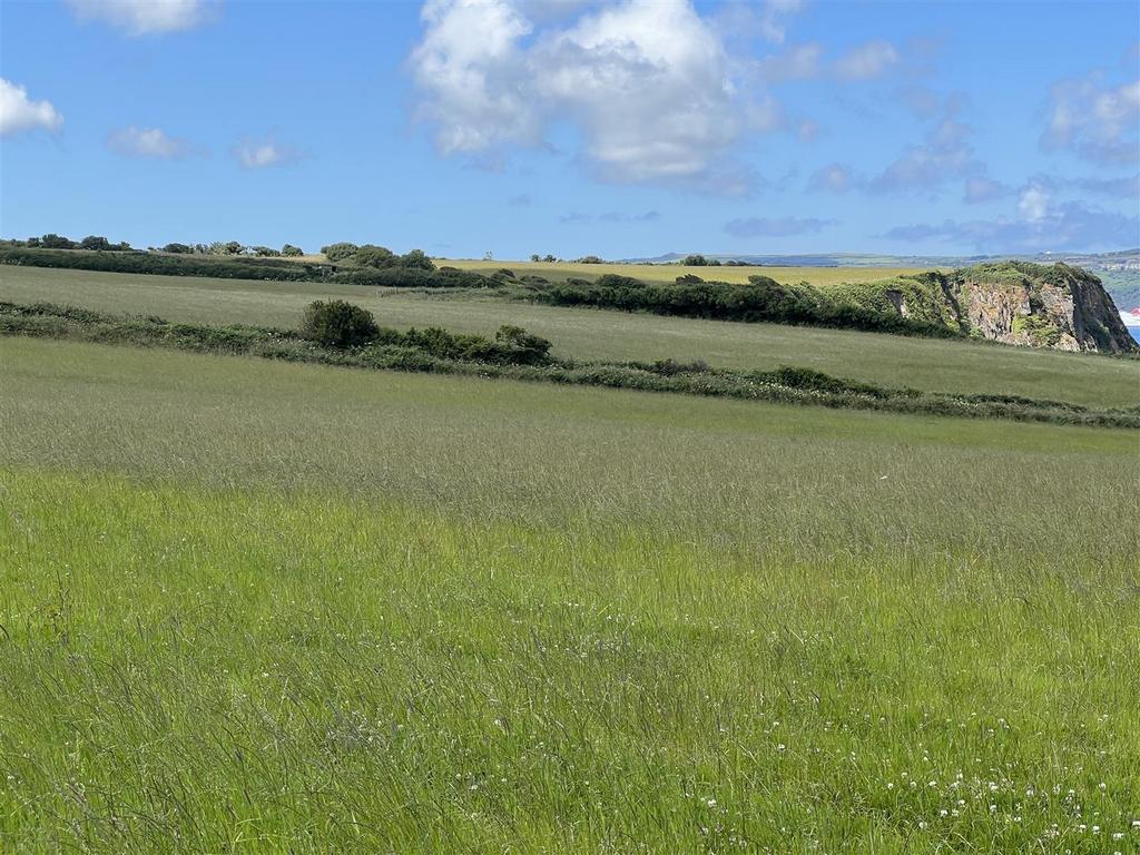
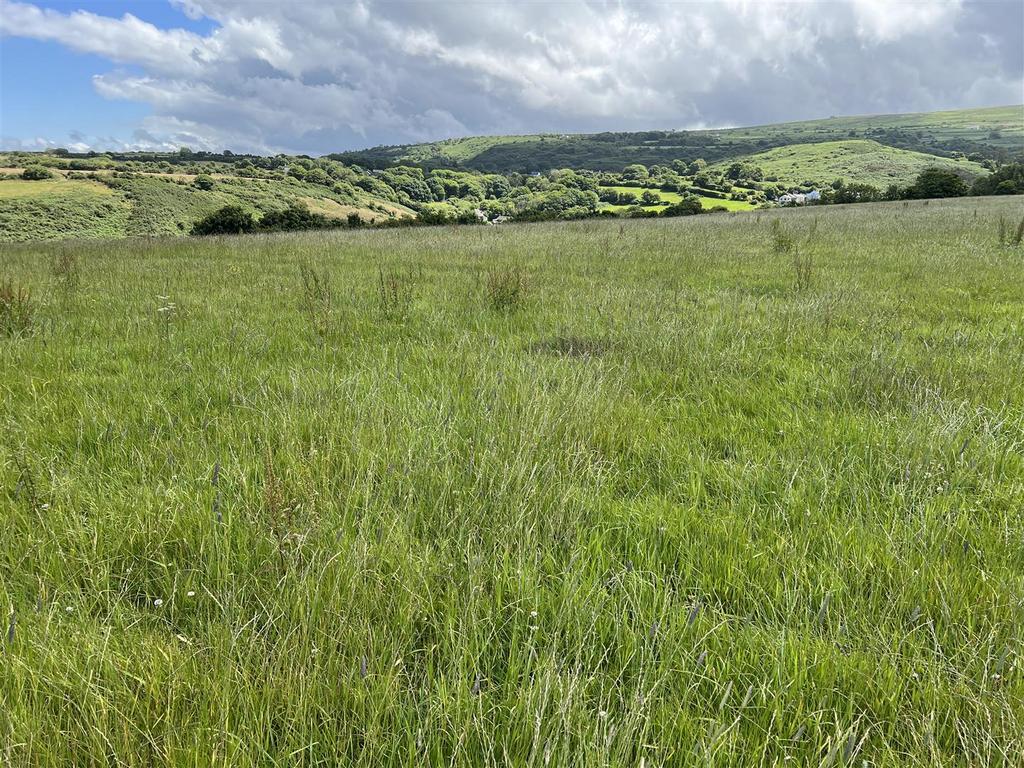
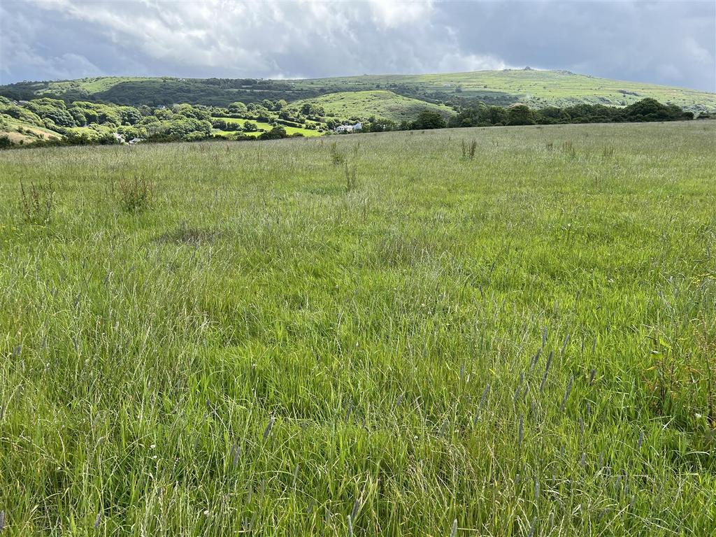
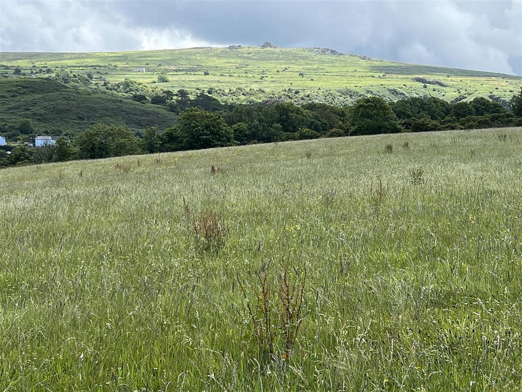
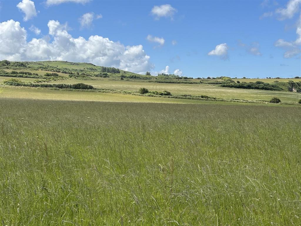
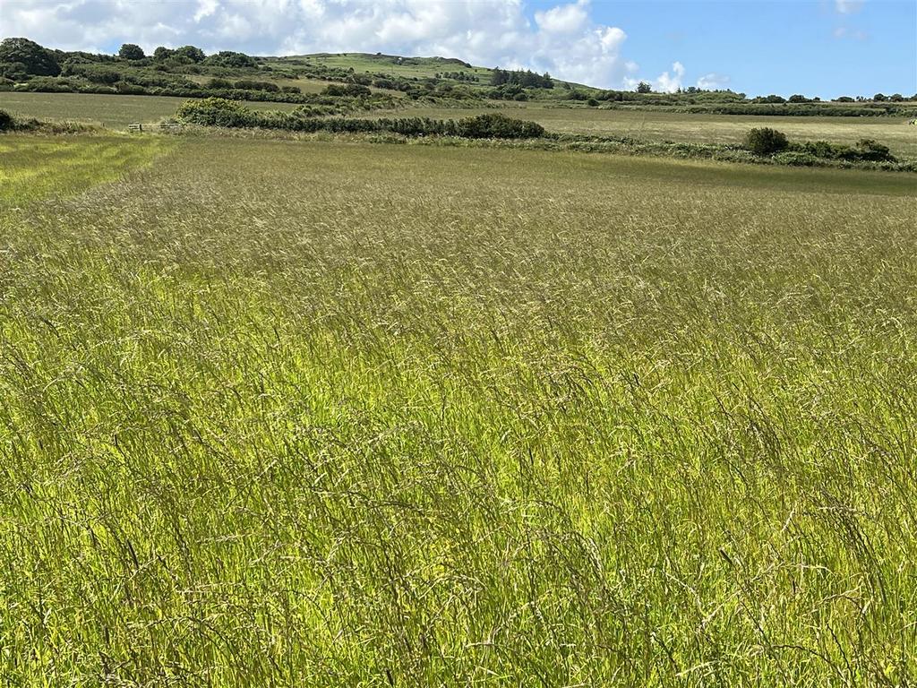
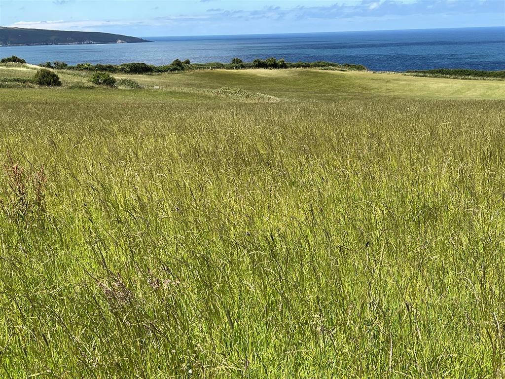
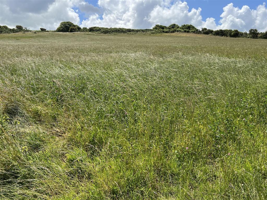
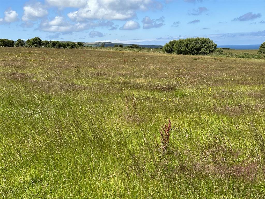
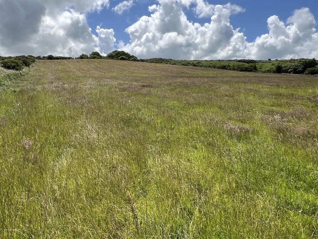
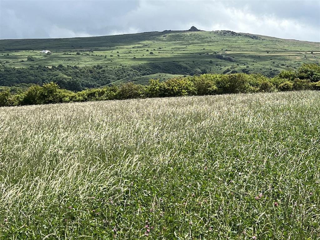
- 86 Acres or thereabouts of Land with approx 78 Acres of clean Pasture/Arable Land.
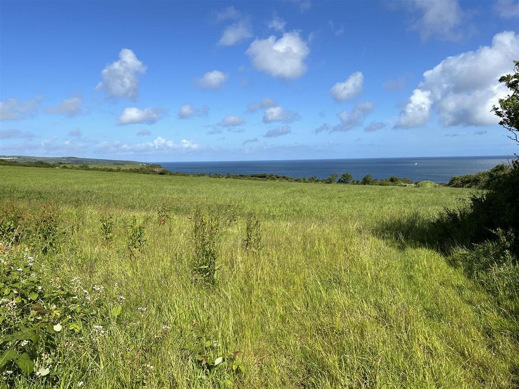
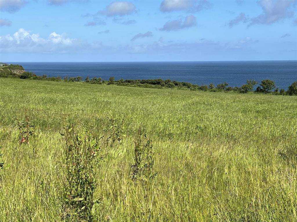
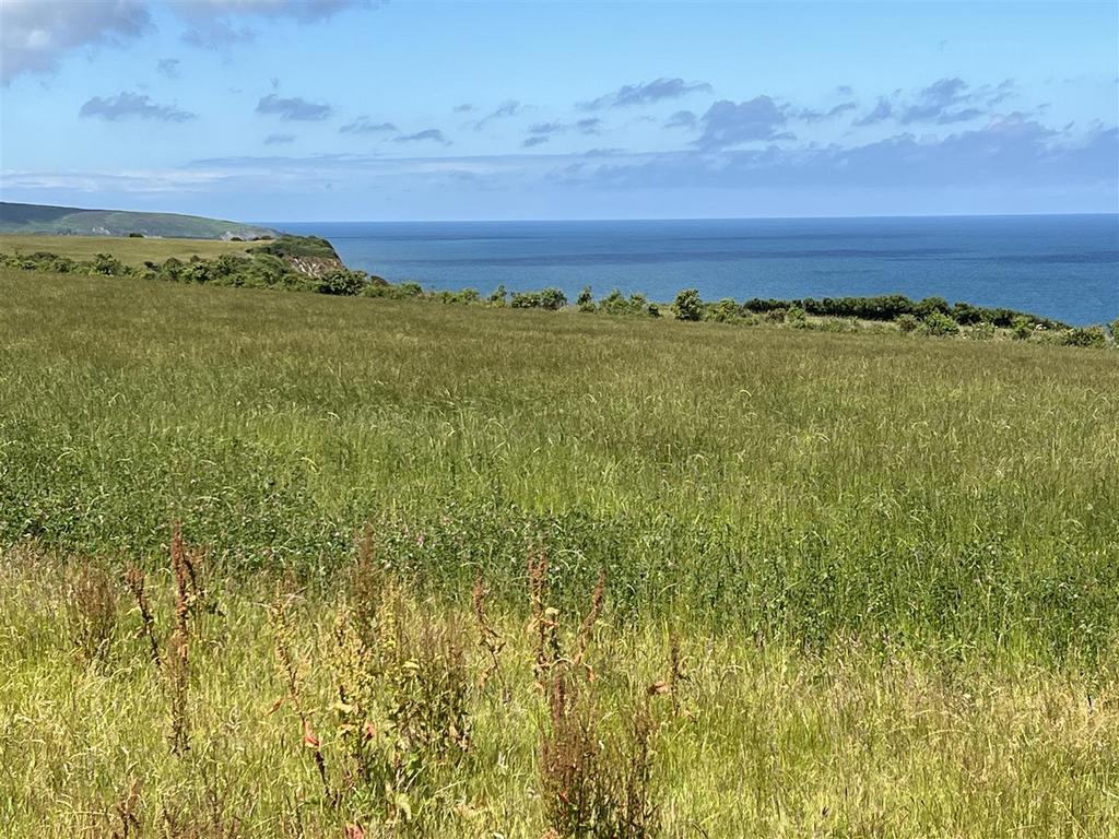
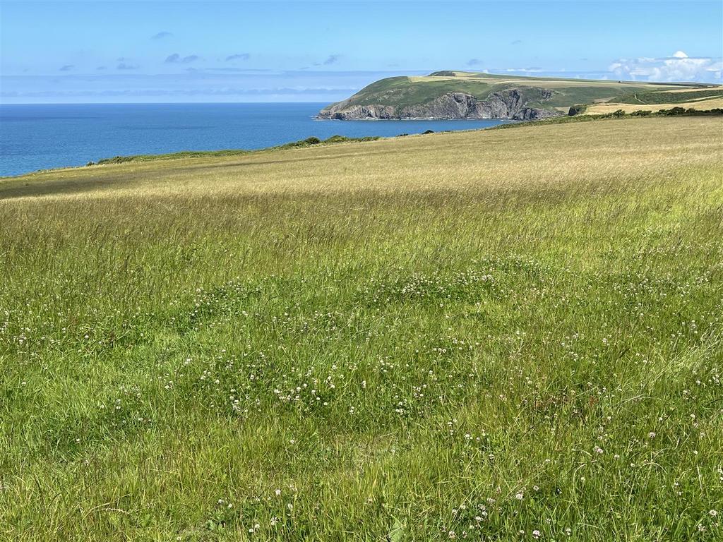
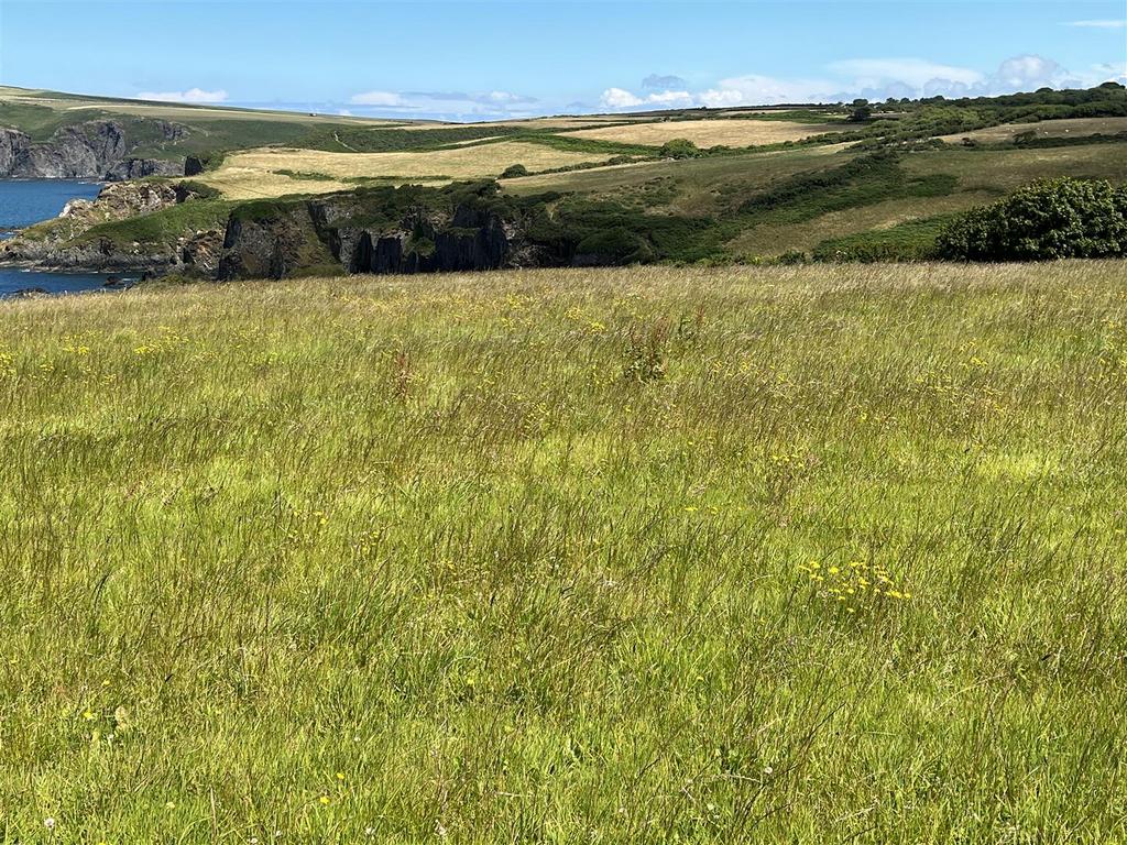
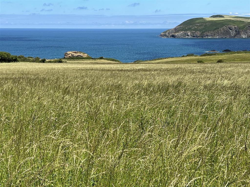
- Approximately 8 Acres or thereabouts of Coastal Slopes and Cliff Land extending down to Mean High Water.
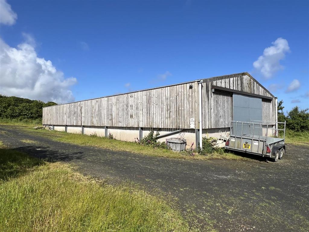
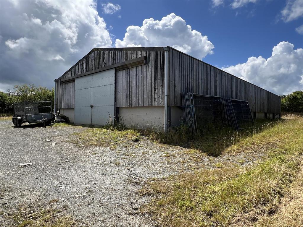
- Substantial Agricultural/Multipurpose Building 90'0" x 40'0" of a Steel Portal Frame Construction with a Corrugated Cement Fibre Roof.
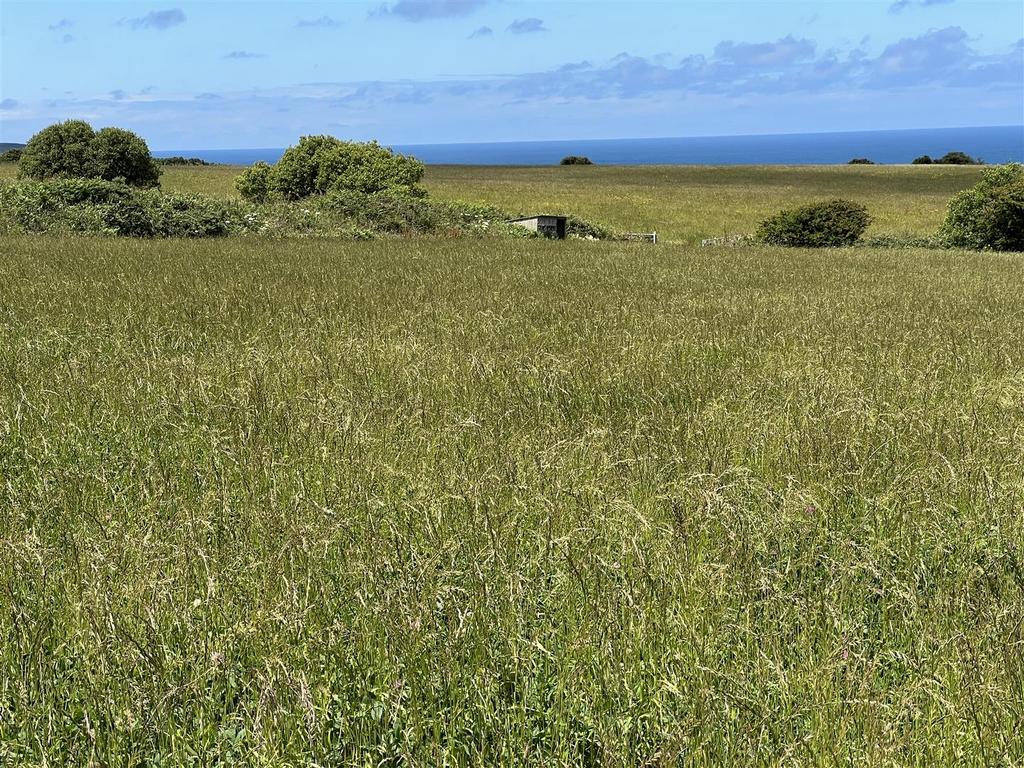
- The Land is in good sized enclosures and is in the main, level lying or gently sloping with a northerly or north westerly aspect.
- It was farmed Organically from 2008 until Summer 2023. Since October 2023 the land status is now known as regenerative.
- Rarely do good blocks of Agricultural Land appear on the 'Open Market' on the North Pembrokeshire Coastline and the opportunity to purchase should not be missed.
Situated on The North Pembrokeshire Coastline, a valuable and early block of Agricultural Land which extends to 86 Acres or thereabouts of which there is approximately 78 Acres of clean Pasture/Arable Land and approximately 8 Acres or thereabouts of Coastal Slopes and Cliff Land extending down to Mean High Water. In addition, there is a substantial Agricultural/Multipurpose Building 90'0" x 40'0" of a Steel Portal Frame Construction with a Corrugated Cement Fibre Roof. The Land is in good sized enclosures and is in the main, level lying or gently sloping with a northerly or north westerly aspect which was farmed Organically from 2008 until Summer 2023. Since October 2023 the land status is now known as regenerative. Rarely do good blocks of Agricultural Land appear on the 'Open Market' on the North Pembrokeshire Coastline and the opportunity to purchase should not be missed. Realistic Price Guide.
Situation - Trewrach Farm is situated on the North Pembrokeshire Coastline between the Market Town of Fishguard (3 ½ miles west) and the Coastal Village of Dinas Cross ( 1 ½ miles east).
Dinas Cross being close by has the benefit of a Petrol Filling Station/Post Office/General Store, 2 Public Houses, a Fish & Chip Shop Take-Away, Village/Community Hall, a Church, 2 Chapels, a Cafe and a Licensed Restaurant/Public House at Pwllgwaelod.
The Pembrokeshire Coastline at Aberbach is within a half a mile or so of the Property by road and also close by are the other well known sandy beaches and coves at Pwllgwaelod, Cwm-yr-Eglwys, Aberfforest, Aber Rhigian, Cwm, Parrog, Newport Sands, Ceibwr and Poppit Sands.
The well known Market Town and Ferry Port of Fishguard is within easy car driving distance and has the benefit of a good Shopping Centre together with a wide range of amenities and facilities including Secondary and Primary Schools, a Health Centre, 2 Dentists, Churches, Chapels, a Building Society, Hotels, Restaurants, Public Houses, Cafes, Take-Away's, Art Galleries, a Cinema/Theatre, Supermarkets, a Post Office, Library and a Leisure Centre,
The popular well known Coastal and Market Town of Newport is within 4 miles or so and some 15 miles or so north east is the other well known Market Town of Cardigan.
The County and Market Town of Haverfordwest is some 18 miles or so south and has the benefit of an excellent Shopping Centre together with an extensive range of amenities and facilities including Secondary and Primary Schools, Churches, Chapels, Banks, Building Societies, Hotels, Restaurants, Public Houses, Cafes, Take-Away's, a Post Office, Library, Repair Garages, Supermarkets, Petrol Filling Stations, a Further Education College, the County Council Offices and the County Hospital at Withybush.
The Land concerned is situated within The Pembrokeshire Coast National Park which is designated an area of Outstanding Natural Beauty and protected accordingly.
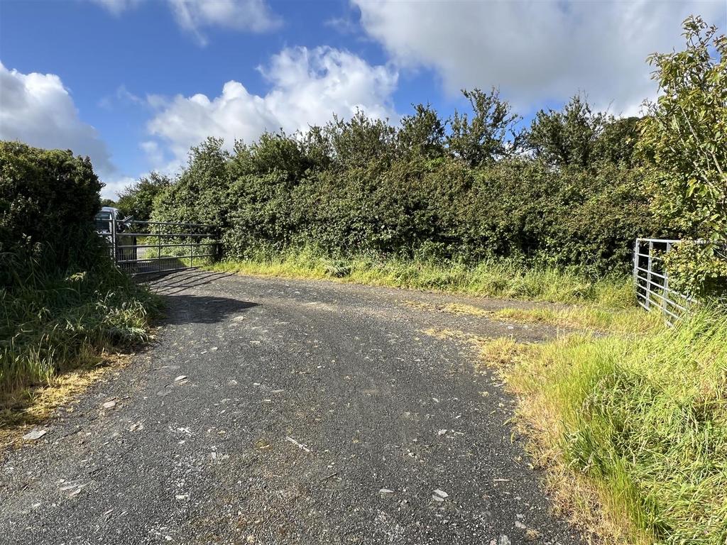
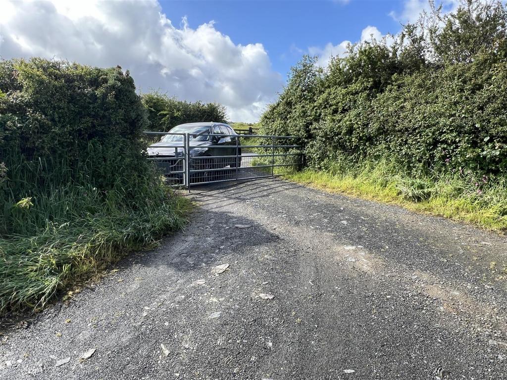
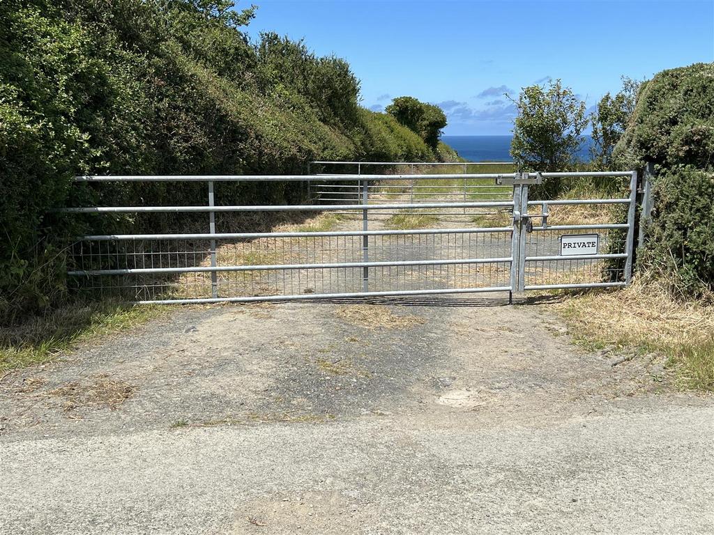
Directions - From Fishguard, take the Main A487 Road east in the direction of Newport for some 3 miles passing the turning on the right, signposted to Llanychaer and a 100 yards or so further on, take the first turning on the left. Continue on this road for 450 yards or so and follow the road 90° to the right. Proceed down the hill for 200 yards or so and the Farm Gate Entrance to the Land concerned is situated on the left hand side of the road (directly opposite the turning on the right into Trewrach Farm) and is indicated with the letter "A" on the Plan. A "For Sale" Board is erected at this point.
Alternatively from Cardigan, take the Main A487 Road south west for some 13 miles passing through the village of Dinas Cross and a mile or so further on and after leaving the village, take the turning on the right hand side of the road (100 yards or so prior to the turning on the left for Llanychaer). Follow directions as above.
Description - The Land in total extends to some 86 Acres or thereabouts of which there is approximately 78 Acres of predominantly clean Pasture and Arable Land which is in the main, level lying or gently sloping with a northerly or north westerly aspect. The Land is all down to permanent Pasture and the perimeter boundary of the Land is sheep fenced which has been farmed Organically from 2008 until Summer 2023. Since October 2023 the Land status is now known as regenerative. The Pembrokeshire Coast Footpath runs alongside the northern boundary of the clean Agricultural Land and bisects the Pasture Land from the Coastal Slopes and Cliff Land. There is approximately 8 Acres or thereabouts of Coastal Slopes and Cliff Land (extending down to Mean High Water) which runs alongside the northern boundary of the Land from Aberbach beach in a westerly direction towards Fishguard.
There are 2 Timber built Sheep Sheds/Shelters as well as a Timber built Store/Hay/Livestock Building with a corrugated iron roof which is situated at the southernmost boundary of O.S. No. 9227.
Situated in O.S. No. 2432 is a:-
Multipurpose Agricultural Building - 27.43m' x 12.19m (90'0' x 40'0") - Of steel stanchion and shuttered concrete wall construction with Yorkshire board cladding under a pitched corrugated cement fibre roof. It has a concreted floor and is wired for Electricity from a diesel generator. There are double 8'0" wide galvanised sliding steel doors at each end of the building which is divided into 2 Sheds which measure 60'0" x 40'0" and 40' x 30'0" and divided by a Steel and Timber dividing wall.
There is also a:-
Steel Container - 6.10m x 2.44m (20'0" x 8'0") - Which houses a diesel generator.
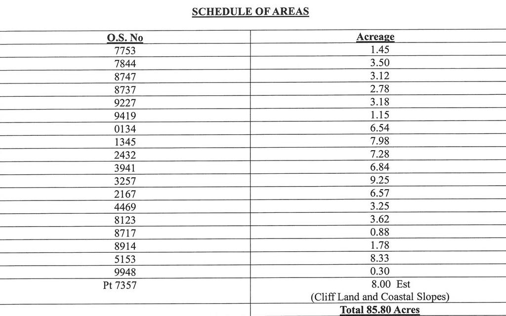
The approximate boundaries of the entire Property are edged in red on the attached Plan to the Scale of 1/2500 and are set out in the:-
Schedule Of Areas -
Services - There are no Mains Services connected to the Land. There is a Borehole for Water close to the Steel Container from where water is pumped to a header tank in the Multipurpose Barn.
Tenure - Freehold with Vacant Possession of the Land with possession available at the end of 2024 or early 2025.
Footpath Rights Of Ways - The Pembrokeshire Coast Footpath runs alongside the northern boundary of the clean Pasture Land and bisects the Coastal Slope Land.
Agricultural Holding Number - 55/480/0086
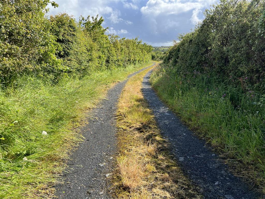
Remarks - Rarely do good blocks of early growing Agricultural Land on the North Pembrokeshire Coastline appear on the Open Market and the opportunity to purchase should not be missed. Of the total acreage there is approximately 78 Acres or thereabouts of clean Pasture/Arable Land and approximately 8 Acres or thereabouts of Coastal Slopes and Cliff Land. The Land is accessed off the Main A487 Fishguard to Cardigan Road over a single track tarmacadamed Council Maintained Road which leads down the Land and continues down to Aberbach Beach. Field O.S. Numbers 2432, 3941 and 5153 have Council Road frontage. In addition, there is an exceptional 90'0" x 40'0" Steel Portal Frame Building with Shuttered Concrete Walls and Yorkshire Board Cladding under a pitched Corrugated Cement Fibre roof. It has a concreted floor and 16'0" wide openings at each end with double 8'0" wide galvanised steel sliding doors. The Building is divided into two with the largest section being 60'0" x 40'0" and the smaller section 40'0" x 30'0".
Agricultural Properties of this nature on the North Pembrokeshire Coastline rarely appear on the Open Market and the opportunity to purchase an exceptionally good block of early growing Land should not be missed. Early inspection strongly advised.
N.B. The Headland, Cliffs and Coastal Slopes shaded green on the Plan and known as Penrhyn Erw-goch is excluded from the Sale.
Property information from this agent
About this agent

We are an independent firm of Chartered Surveyors, Estate Agents, Valuers and Auctioneers situated within South West Wales with high profile strategically located offices in Cardigan, Fishguard, Haverfordwest and Narberth, offering a wide range of services throughout Pembrokeshire, West Carmarthenshire and South Ceredigion. Specialists in the sale and rental of a wide variety of residential and commercial property, land, farms and smallholdings. We operate three livestock markets in Cardigan, Whitland and Crymych for all classes of livestock.
Similar properties
Discover similar properties nearby in a single step.


