


Land for sale
Key information
Features and description
- Tenure: Freehold (1 years remaining)
A UNIQUE OPPORTUNITY TO ACQUIRE A MOST CONVENIENTLY SITUATED 36.63 ACRES OF QUALITY AGRICULTURAL LAND LOCATED BETWEEN THE VILLAGES OF LYDSTEP & MANORBIER.
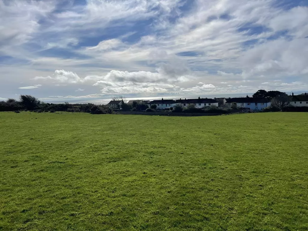
*Approximately 36.63 acres of productive agricultural land*
*Laid to clean pasture*
*Suitable for Grazing and Mowing purposes*
*Water Connection*
*GUIDE PRICE £315,000*
SITUATION
The land is situated between the villages of Lydstep and Manorbier in South Pembrokeshire along the B4585 road. The land lies approximately approximately 5 miles south west from the seaside town of Tenby and approximately 7 miles south east of the town of Pembroke.
PROPERTY DESCRIPTION
The agricultural land at Baldwins Moor extends in all to approximately 36.63 acres split into 6 enclosures. The land is laid to clean pasture and suitable for both livestock grazing and silage mowing purposes. The land is slightly sloping in nature and benefits from both roadside access and a mains water supply.
OS GRID REFERENCE
SS08139807
DIRECTIONS
From Pembroke, take the Upper Lamphey Road. On entering the village of Lamphey turn right to stay on the A4139 through the villages of Hodgeston and Jameston for approximately 4.5 miles. At the Manorbier/Skrinkle Haven junction turn right onto the B4585 and the destination will be on your left. A ‘For Sale‘ Board is erected at the end of the lane.
OVERAGE PROVISION
An overage (claw back) clause will apply to the land and will trigger if planning permission is subsequently obtained for a non-agricultural use. The clause will apply for 25 years and will entitle the seller to 50% of the increase in value associated with the grant of planning consent.
The property is edged red for identification purposes on the enclosed plan.
THE LAND
The land at Baldwins Moor extends to approximately 36.63 acres and is split into 6 enclosures and laid to permanent grass pasture which has historically been used for grazing livestock and silage purposes. Of the 36.63 acres, approximately 21.18 acres of the land is considered to be good quality productive agricultural land with approximately 15.08 acres being slightly poorer quality with evidence of rush in areas and wet in nature however is still considered productive and suitable for grazing purposes. There is also approximately 0.37 acres of land laid to woodland.
The land is slightly sloping in nature benefitting from direct roadside access off the public highway (B4585) Manorbier road and is connected to a mains water supply. The land is fenced externally along the boundaries, however the internal enclosures are not suitably stock proof and can be utilised as one large grazing block. In accordance with soil Scapes the land is largely considered to contain freely draining slightly acid loamy soils.
AGRI-ENVIRONMENT SCHEMES
The land is not entered into any Agri-environmental schemes and there is no apparent environmental factors affecting the land but has been used for BPS purposes in the past.
TENURE AND POSSESSION
The property is currently subject to a sitting tenant to which Notice to Quit has been served. Vacant possession is available from 28th September 2025.
EASEMENTS, RIGHTS OF WAY AND WAYLEAVES:
Please refer to the deeds for the property.
SPORTING, MINERAL & TIMBER RIGHTS
All sporting, mineral and timber rights will be included within the freehold as far as they are owned.
NATIONAL RESOURCES WALES
From the National Resources Wales Flood maps we understand that the land is not susceptible to flooding.
STATUTORY AUTHORITIES
Pembrokeshire Coast National Park, Llanion Park, Pembroke Dock, Pembrokeshire, SA72 6DY
Telephone:[use Contact Agent Button]
Welsh Government (Agricultural Department), Picton Terrace, Carmarthen, SA31 3BT.
Telephone:[use Contact Agent Button]
National Resources Wales (NRW), Customer Care Centre, Ty Cambria, 29 Newport Rd, Cardiff, CF24 0TP
Telephone:[use Contact Agent Button]
BASIC PAYMENT ENTITLEMENTS:
Basic Payment Entitlements are not included within the sale.
METHOD OF SALE
The property is offered for sale by Private Treaty.
VIEWING ARRANGEMENTS
Strictly by appointment with the selling agent.
VENDOR'S SELLING AGENT:
Edward H Perkins Rural Chartered Surveyors, St John House, Salutation Square, Haverfordwest, Pembrokeshire, SA61 2LG.
Telephone:[use Contact Agent Button]
[use Contact Agent Button]
If you have any enquiry regarding the property, please ask to speak to Isabelle Evans.
PLANS AND PARTICULARS:
The information and plans provided within these sale particulars have been prepared for the convenience of prospective purchasers. Although they are believed to be correct, they do not consitute any part of an offer or contract. Statements made within these sale particulars are made without any responsibility on the part of the vendor or their appointed Selling Agent, and any intending purchasers must satisfy themselves by inspection or otherwise as to the correctness of these statements made and contained in these particulars.
Plans are provided for identification purposes only.